MODIFICA LOS D.S. (M) Nº 359, DE 29 SEPTIEMBRE DE 1994, Y D.S. (M) Nº 350, DE 19 DE NOVIEMBRE DE 1996, DEL MINISTERIO DE DEFENSA NACIONAL, QUE FIJAN ÁREAS APROPIADAS PARA EL EJERCICIO DE LA ACUICULTURA EN LA XI REGIÓN AYSÉN DEL GENERAL CARLOS IBÁÑEZ DEL CAMPO
Núm. 201.- Santiago, 29 de julio de 2010.- Visto lo dispuesto en:
a.- El artículo 32, Nº 6º, de la Constitución Política de la República de Chile, cuyo texto refundido, coordinado y sistematizado fue fijado en el D.S. Nº 100, de 2005, del Ministerio Secretaría General de la Presidencia.
b.- La Ley Nº 18.575, Orgánica Constitucional de Bases Generales de la Administración del Estado, cuyo texto refundido, coordinado y sistematizado fue fijado en el D.F.L. Nº 1, de 2000, del Ministerio Secretaría General de la Presidencia.
c.- La Ley Nº 18.892, General de Pesca y Acuicultura, cuyo texto refundido, coordinado y sistematizado fue fijado por D.S. Nº 430, de 1991, del Ministerio de Economía, Fomento y Reconstrucción.
d.- El D.S. Nº 19, de 2001, del Ministerio Secretaría General de la Presidencia, que faculta a los Ministros de Estado para firmar "Por orden del Presidente de la República".
e.- La Resolución Nº 1.600, de 2008, de la Contraloría General de la República, que fija Normas sobre Exención del Trámite de Toma de Razón.
f.- El Dictamen Nº 052692, de 23 de septiembre de 2009, del Sr. Contralor General de la República.
Considerando:
a.- Los Decretos Supremos (M) Nº 359, del 29 de septiembre de 1994, que fijó las Áreas Apropiadas para el ejercicio de la Acuicultura (A.A.A.) de la XI Región de Aysén, y sus modificaciones contenidas en el D.S. (M) Nº 100, del 06 de abril de 1995, y el D.S. (M) Nº 027, del 06 febrero 2004; Nº 350, de 19 de noviembre de 1996, que fijó las A.A.A en la Reserva Nacional Las Guaitecas Archipiélago de los Chonos; y Nº 252, de 3 de septiembre de 2009, que modifica los Decretos Supremos (M) Nº 359, de 1994, y Nº 350, de 1996; todos los Decretos Supremos mencionados del Ministerio de Defensa Nacional.
b.- El D.S. (M) Nº 153, del 20 de mayo de 2004, del Ministerio de Defensa Nacional, que declara Áreas de Usos Preferentes Específicos los espacios del Borde Costero del Litoral de la XI Región de Aysén del General Carlos Ibáñez del Campo, publicado con fecha 16 de mayo de 2005 en el Diario Oficial, y los documentos complementarios que forman parte integrante de dicho Decreto Supremo.
c.- Que, de acuerdo a lo señalado en el punto 4.- del D.S. (M) Nº 153, del 20 de mayo de 2004, antes mencionado, la Subsecretaría de Pesca presentó a la Subsecretaría de Marina los Informes Técnicos (D.AC.) Nº 1243 y 1244, ambos del 9 de noviembre de 2006, aportando los antecedentes e información cartográfica para la modificación del D.S. (M) Nº 359, de 1994, y del D.S. (M) 350, de 1996, respectivamente. En virtud de los mismos informes se decretó, además, la desafectación de A.A.A. en la Región de Aysén mediante el D.S. (M) Nº 252 señalado en la letra a.- anterior.
e.- Que, en el D.S. (M) Nº 350, de 1996, se omitieron puntos de fondeo para buques y embarcaciones, los cuales es necesario incorporar con el objeto de cumplir con las normas de seguridad que regulan la navegación. Y que, al efecto, de acuerdo con lo señalado por el Jefe del Estado Mayor General de la Armada mediante Oficio Ord. Nº12.210/1311 SS.FF.AA., de 29 de marzo de 2010, la Capitanía de Puerto de Puerto Chacabuco estableció los puntos de fondeo recomendados para los sectores incluidos en dicho Decreto, de acuerdo a las condiciones geográficas, corrientes, tipo de fondo, vientos y características generales del puerto. Adicionalmente, en dicho oficio se indicó la sugerencia de la Capitanía de Puerto de Río Baker de desafectar el Sector Desembocadura del Río Baker, por presentar riesgos para la operación de centros de cultivo, debido a la ocurrencia de frecuentes crecidas y desbordes por deshielos, los cuales arrastran ramas y troncos al referido delta, pudiendo ocasionar accidentes, tanto de personal marítimo, como de embarcaciones.
f.- Que, actualmente, las A.A.A. contempladas en el D.S. (M) Nº 359, del 29 de septiembre de 1994 y en el D.S. (M) Nº 350, del 19 de noviembre de 1996, están referidas a las cartas náuticas del Servicio Hidrográfico y Oceanográfico de la Armada (S.H.O.A.), ediciones desde el año 1945 al año 1985, todas con antiguo Datum Local y sin referencia geodésica, siendo por lo tanto incompatibles con la tecnología actualmente en uso para el posicionamiento geográfico de la actividad de acuicultura, lo que conlleva errores de coordenadas y superposiciones documentales entre concesiones, que en la mayoría de los casos no existen en terreno.
g.- Lo informado y certificado por el S.H.O.A. respecto de la transformación de las coordenadas geográficas de las A.A.A. fijadas por los D.S. (M) Nº 359, de 1994, y D.S. (M) Nº 350, de 1996, mediante los oficios SHOA Ord. Nº 12.210/10, de fecha 03 de junio de 2003, Nº 12.210/07/13, de fecha 24 de julio de 2003, Nº 12.210/07/16, de fecha 28 de octubre de 2003; Nº 12.210/07/11, de fecha 12 de junio de 2003; Nº 13.000/24/163, de fecha 01 de agosto de 2005; Nº 13.000/24/201, de fecha 12 de septiembre de 2005, y Nº 13.000/24/205, de fecha 19 de octubre de 2006, todo lo anterior con el objeto de cerrar correctamente el trazado de los polígonos que encierran el área de cada A.A.A., manteniendo su superficie.
h.- Que el S.H.O.A. ha reemplazado las antiguas cartas por otras nuevas, que actualmente son las que se encuentran vigentes de acuerdo a su catalogamiento, a escala 1:300.000, 1:250.000, 1:125.000, 1:50.000, 1:25.000, 1:10.000. Estas nuevas cartas cuentan con referencia geodésica y un régimen de coordenadas basadas en los Datum Sudamericano de 1969 (SAD1969) y Geodésico Mundial de 1984 (WGS-84), siendo por lo tanto una fiel representación en el papel de la realidad geográfica, lo que permitirá regularizar en forma definitiva la situación de un número importante de titulares de concesión de acuicultura y normalizar la tramitación de otras que se encuentran pendientes. Por su calidad, las nuevas cartas permitirán ubicar los polígonos de cada concesión de acuerdo a la posición que les corresponde en la realidad.
i.- Resoluciones Exentas Nº 3614, de 2007, que propone Modificación de Áreas Apropiadas para el Ejercicio de la Acuicultura en la XI Región y Nº 2171, de 2009, que modifica la anterior, ambas de la Subsecretaría de Pesca, las cuales no fueron objetadas en las oportunidades legales.
j.- Oficio J.E.M.G.A. Ord. Nº 12.210/1311, de fecha 29 de marzo de 2010, que remite informe de la Dirección de Intereses Marítimos y Medio Ambiente Acuático, cuyas observaciones se han incorporado a la propuesta de modificación a las A.A.A.
k.- Que, el oficio de la Subsecretaría de Pesca (D.J.) Ord. Nº 823, de fecha 10 de mayo de 2010, hace presente que, de acuerdo con el inciso primero del artículo 67 de la Ley General de Pesca y Acuicultura, modificado por la Ley 20.434, los decretos que fijen las A.A.A. señalarán el grupo o grupos de especies hidrobiológicas que pueden ser objeto de cultivo en ellas. No obstante lo anterior, en el párrafo 2 del citado oficio, indica que "resulta necesario aclarar que los informes técnicos emitidos por esta Subsecretaría respecto del establecimiento y modificación de áreas para el ejercicio de la acuicultura, cuyos decretos se encuentran pendientes, no consideran el cultivo en forma exclusiva de ningún grupo o grupos de especies hidrobiológicas en particular, pudiendo en consecuencia realizarse en dichas áreas actividades de acuicultura de toda clase o grupo de especie hidrobiológica sin más restricción que aquellas señaladas por la ley y sus regla-mentos".
l.- Que, el inciso final del artículo 67 de la Ley General de Pesca y Acuicultura, introducido asimismo por la Ley 20.434, dispone que, en caso de que en la región respectiva se haya establecido una zonificación del borde costero cuyo decreto supremo de aprobación haya sido publicado en el Diario Oficial, las A.A.A. deberán modificarse a fin de compatibilizarse con dicha zonificación. Habiéndose publicado el 16 de mayo de 2005 el D.S. (M) Nº 153, de 2004, que declara Áreas de Usos Preferentes Específicos los Espacios del Borde Costero del Litoral de la XI Región Aysén del General Carlos Ibáñez del Campo, de acuerdo con la Carta y Memoria de Zonificación respectivas, se produce en la especie la situación regulada en dicho inciso final del artículo 67. No obstante, de acuerdo con el Nº 4 de dicho D.S. (M) Nº 153, y con el numeral 4.2.2. de la Memoria de Zonificación que forma parte del mismo Decreto Supremo, con fecha 9 de septiembre de 2009 se dictó el D.S. (M) Nº 252, mencionado en la letra a.- anterior, y sobre la base de los Informes Técnicos señalados en la letra d.- de estos Considerandos, por el cual se dio cumplimiento a las exigencias de desafectación de A.A.A. establecidas en la Zonificación regional del Borde Costero, con lo cual cabe entender dicha Zonificación no establece otras incompatibilidades por las cuales deba modificarse la superficie de las áreas establecidas a la fecha como apropiadas para el ejercicio de la acuicultura.
m.- Que, no obstante lo señalado en la letra l.- anterior, en la desafectación de A.A.A. realizada mediante el D.S. (M) Nº 252, de 2009, publicado en el Diario Oficial de 8 de octubre de 2009, no se mencionó expresamente la desafectación del Sector denominado Saco Isla Kent, correspondiendo igualmente esta última en conformidad con los fundamentos del mismo decreto.
n.- Que, con la finalidad de evitar que las concesiones de acuicultura ubicadas en las áreas desafectadas conforme al mismo D.S. (M) Nº 252, antes citado, y que se encontraban otorgadas y vigentes a la fecha de publicación de dicho Decreto Supremo en el Diario Oficial, se entiendan otorgadas fuera de una A.A.A. declarada en conformidad a la ley, resulta necesario declarar como subsistentes tales A.A.A., solamente en la extensión cubierta por tales concesiones, y en tanto estas últimas se mantengan vigentes, sin perjuicio de las coordenadas fijadas para las A.A.A. subsistentes por el Decreto antes mencionado,
Decreto:
I.- Modifícase el D.S. (M) Nº 359, del 29 de septiembre de 1994, modificado anteriormente por los D.S. (M) Nº 100, de 1995; Nº 27, de 2004, y Nº 252, del 2009, en la siguiente forma:
A. En el numeral 1, introdúcense las siguientes
modificaciones:
1.- Reemplázase el encabezado del numeral 1.-
por el siguiente:
"Fíjanse como Áreas Apropiadas para el
Ejercicio de la Acuicultura (A.A.A.) en la
XI Región Aysén del General Carlos Ibáñez
del Campo, los terrenos fiscales, playa de
mar, porciones de agua y fondo, rocas,
dentro y fuera de las bahías, comprendidos
entre las latitudes 43º 44' 26,00" Sur y 48º
50' 30,00" Sur, y circunscritos por las
líneas imaginarias que unen las coordenadas
geográficas de los vértices que especifican
su perímetro, que se indican en las cartas
náuticas editadas por el Servicio
Hidrográfico y Oceanográfico de la Armada
(S.H.O.A.), que a continuación se expresan:"
2.- Modifícase el "ÁREA ISLAS GUAITECAS" en el
siguiente sentido:
1.1. Reemplázase la carta de referencia por
la siguiente: Carta SHOA vigente N°8100,
escala 1:100.000, 2ª ed. 1952, Datum Local.
1.2. Reemplázanse los sectores "Surweste
Isla Ascensión", "Isla Clotilde", "Islas
Bajas", "Sur Canal Tuamapu", "Isla Yates-
Isla Campos", "Isla Aguda e Islotes Locos",
por los siguientes:
a) Sector: Surweste de Isla Ascensión
COORDENADAS NUEVAS (LOCAL)
Punto Latitud S Longitud W
1 43º 54' 24,00" 73º 51' 15,00"
2 43º 53' 38,00" 73º 53' 31,00"
3 43º 52' 08,00" 73º 54' 15,00"
4 43º 51' 46,00" 73º 53' 41,00"
b) Sector: Isla Clotilde
COORDENADAS NUEVAS (LOCAL)
Punto Latitud S Longitud W
1 43º 55' 30,00" 73º 45' 57,00"
2 43º 57' 20,00" 73º 45' 55,00"
3 43º 57' 50,00" 73º 46' 44,00"
4 43º 56' 27,00" 73º 50' 00,00"
5 43º 55' 41,00" 73º 51' 32,00"
6 43º 54' 41,00" 73º 51' 48,00"
7 43º 54' 32,00" 73º 50' 45,00"
8 43º 54' 38,00" 73º 48' 18,00"
9 43º 54' 16,00" 73º 46' 28,00"
c) Sector: Islas Bajas
COORDENADAS NUEVAS (LOCAL)
Punto Latitud S Longitud W
1 43º 56' 08,00" 74º 12' 44,00"
2 43º 55' 27,00" 74º 08' 34,00"
3 43º 56' 05,00" 74º 03' 43,00"
4 43º 58' 10,00" 74º 03' 30,00"
5 43º 58' 22,00" 74º 10' 05,00"
d) Sector: Sur de Canal Tuamapu
COORDENADAS NUEVAS (LOCAL)
Punto Latitud S Longitud W
1 44º 02' 00,00" 74º 17' 00,00"
2 44º 02' 00,00" 74º 18' 41,00"
3 43º 59' 46,00" 74º 16' 57,00"
4 43º 59' 06,00" 74º 13' 27,00"
5 44º 00' 40,00" 74º 04' 30,00"
6 44º 01' 47,00" 73º 48' 33,00"
7 44º 02' 00,00" 73º 49' 24,00"
8 44º 02' 00,00" 74º 07' 09,00"
9 44º 02' 00,00" 74º 07' 30,00"
10 44º 02' 00,00" 74º 10' 39,00"
e) Sector: Isla Yates - Isla Campos
COORDENADAS NUEVAS (LOCAL)
Punto Latitud S Longitud W
1 43º 52' 42,00" 73º 40' 24,00"
2 43º 52' 42,00" 73º 41' 31,00"
3 43º 52' 22,00" 73º 39' 44,00"
4 43º 54' 12,00" 73º 38' 54,00"
5 43º 54' 38,00" 73º 39' 21,00"
6 43º 54' 26,00" 73º 40' 10,00"
7 43º 54' 13,00" 73º 40' 10,00"
8 43º 54' 06,00" 73º 40' 10,00"
9 43º 53' 49,00" 73º 40' 10,00"
10 43º 53' 42,00" 73º 40' 10,00"
11 43º 53' 18,00" 73º 40' 10,00"
f) Sector: Isla Aguda
COORDENADAS NUEVAS (LOCAL)
Punto Latitud S Longitud W
1 43º 54' 17,00" 73º 38' 18,00"
2 43º 54' 22,00" 73º 35' 38,00"
3 43º 55' 31,00" 73º 34' 37,00"
4 43º 56' 09,00" 73º 35' 46,00"
5 43º 55' 39,00" 73º 37' 23,00"
g) Sector: Islotes Locos
COORDENADAS NUEVAS (LOCAL)
Punto Latitud S Longitud W
1 43º 58' 27,00" 73º 27' 42,00"
2 43º 59' 03,00" 73º 26' 43,00"
3 43º 59' 45,00" 73º 27' 10,00"
4 43º 59' 10,00" 73º 27' 59,00"
"
3.- Reemplázase íntegramente el "ÁREA PUERTO
MELINKA" por la siguiente:
"ÁREA: PUERTO MELINKA
Carta SHOA vigente Nº 8100, escala 1:25.000,
2ª ed.1952, Datum Local.
a) Sector: Sureste de Isla Ascensión
COORDENADAS NUEVAS (LOCAL)
Punto Latitud S Longitud W
1 43º 52' 41,00" 73º 44' 11,00"
2 43º 52' 41,00" 73º 44' 04,80"
3 43º 54' 07,40" 73º 44' 19,20"
4 43º 54' 09,30" 73º 44' 58,70"
5 43º 54' 02,30" 73º 45' 09,60"
6 43º 54' 01,60" 73º 45' 25,30"
7 43º 53' 54,50" 73º 46' 26,80"
Coordenadas Fondeadero: Radio de borneo de 1 cable
A 43º 53' 58,70" 73º 45' 16,70"
b) Sector: Este de Isla Clotilde
COORDENADAS NUEVAS (LOCAL)
Punto Latitud S Longitud W
1 43º 54' 12,60" 73º 46' 20,10"
2 43º 54' 22,90" 73º 45' 47,40"
3 43º 54' 52,30" 73º 45' 22,30"
4 43º 55' 23,20" 73º 45' 49,80"
5 43º 55' 23,20" 73º 45' 54,60"
c) Sector: Weste Isla Yates - Isla Luisa
COORDENADAS NUEVAS (LOCAL)
Punto Latitud S Longitud W
1 43º 53' 12,30" 73º 40' 10,40"
2 43º 53' 35,80" 73º 40' 10,40"
3 43º 53' 50,40" 73º 40' 10,40"
4 43º 54' 03,30" 73º 40' 10,40"
5 43º 54' 10,30" 73º 40' 10,40"
6 43º 54' 13,70" 73º 40' 10,40"
7 43º 54' 09,70" 73º 40' 41,90"
8 43º 53' 45,20" 73º 41' 44,40"
9 43º 52' 41,00" 73º 41' 07,40"
10 43º 52' 41,00" 73º 41' 00,00"
d) Sector: Isla Günther
COORDENADAS NUEVAS (LOCAL)
Punto Latitud S Longitud W
1 43º 55' 23,20" 73º 42' 21,30"
2 43º 55' 23,20" 73º 42' 24,00"
3 43º 55' 07,70" 73º 42' 23,60"
4 43º 55' 12,40" 73º 41' 33,00"
5 43º 55' 23,20" 73º 41' 24,30"
6 43º 55' 23,20" 73º 41' 31,40"
7 43º 55' 23,20" 73º 41' 40,50"
8 43º 55' 23,20" 73º 41' 46,50"
e) Sector: Isla Tea
COORDENADAS NUEVAS (LOCAL)
Punto Latitud S Longitud W
1 43º 55' 23,20" 73º 40' 21,10"
2 43º 55' 23,20" 73º 40' 27,50"
3 43º 55' 07,20" 73º 40' 32,50"
4 43º 55' 00,00" 73º 40' 10,40"
5 43º 55' 02,80" 73º 40' 10,40"
"
4.- Reemplázase íntegramente el "ÁREA SENO
GALA" por la siguiente:
"ÁREA: SENO GALA
Carta SHOA vigente N° 8511, escala
1:20.000, 1ª ed. 27 de Diciembre 1985,
Datum SAD-69.
a) Sector: Península Melimoyu
COORDENADAS NUEVAS (SAD-69)
Punto Latitud S Longitud W
1 44º 13' 28,70" 73º 10' 35,50"
2 44º 12' 43,00" 73º 10' 40,80"
3 44º 11' 29,10" 73º 07' 24,00"
4 44º 08' 47,00" 73º 06' 51,60"
5 44º 08' 28,80" 73º 06' 31,20"
6 44º 08' 14,00" 73º 06' 46,20"
7 44º 08' 40,50" 73º 07' 15,10"
8 44º 10' 08,80" 73º 07' 32,00"
9 44º 10' 58,70" 73º 08' 01,20"
10 44º 11' 50,50" 73º 09' 20,10"
11 44º 12' 17,10" 73º 10' 48,00"
12 44º 12' 17,10" 73º 14' 06,00"
13 44º 11' 36,30" 73º 17' 18,50"
14 44º 10' 48,00" 73º 18' 00,00"
15 44º 06' 00,00" 73º 18' 00,00"
16 44º 06' 00,00" 73º 12' 46,00"
b) Sector: Islas Harry
COORDENADAS NUEVAS (SAD-69)
Punto Latitud S Longitud W
1 44º 14' 00,00" 73º 13' 57,40"
2 44º 14' 00,00" 73º 15' 30,00"
3 44º 12' 38,10" 73º 16' 29,20"
4 44º 12' 35,00" 73º 13' 56,00"
5 44º 13' 01,80" 73º 11' 14,80"
6 44º 13' 28,20" 73º 11' 11,20"
7 44º 14' 00,00" 73º 11' 19,00"
8 44º 14' 00,00" 73º 12' 34,20"
"
5.- Reemplázase íntegramente el "ÁREA ACCESO
NORTE CANAL MORALEDA" por la siguiente:
"ÁREA: ACCESO NORTE CANAL MORALEDA
Carta SHOA vigente N° 8200, escala
1:250.000, 2ª ed. 25 de Julio 1984 c/c 1989,
Datum Local.
Sector: Isla Refugio
COORDENADAS NUEVAS (LOCAL)
Punto Latitud S Longitud W
1 44º 00' 00,00 " 73º 15' 11,00 "
2 44º 00' 00,00 " 73º 16' 11,00 "
3 44º 00' 00,00 " 73º 16' 29,00 "
4 44º 00' 00,00 " 73º 18' 30,00 "
5 43º 54' 33,00 " 73º 18' 30,00 "
6 43º 46' 34,00 " 73º 04' 00,00 "
7 43º 49' 18,00 " 73º 04' 00,00 "
8 43º 49' 18,00 " 73º 00' 00,00 "
9 43º 49' 52,00 " 73º 00' 00,00 "
10 44º 00' 00,00 " 73º 05' 40,00 "
11 44º 00' 00,00 " 73º 06' 10,00 "
12 44º 00' 00,00 " 73º 07' 49,00 "
13 44º 00' 00,00 " 73º 08' 43,00"
"
6.- Elimínase íntegramente el "ÁREA ACCESO SUR
CANAL MORALEDA".
7.- Reemplázase íntegramente el "ÁREA CANALES
PUYUGUAPI Y JACAF"
"ÁREA: CANALES PUYUGUAPI Y JACAF
Carta SHOA vigente N° 8500, escala
1:250.000, 1ª ed. 1949 c/c 1986, Datum
Local.
a) Sector: Seno Melimoyu
COORDENADAS NUEVAS (LOCAL)
Punto Latitud S Longitud W
1 44º 06' 00,00" 73º 13' 16,00"
2 44º 06' 00,00" 73º 18' 30,00"
3 44º 00' 00,00" 73º 18' 30,00"
4 44º 00' 00,00" 73º 16' 24,00"
5 44º 00' 00,00" 73º 15' 54,00"
6 44º 00' 00,00" 73º 15' 00,00"
7 44º 00' 00,00" 73º 08' 30,00"
8 44º 00' 00,00" 73º 07' 39,00"
9 44º 06' 00,00" 73º 07' 32,00"
10 44º 06' 00,00" 73º 08' 46,00"
b) Sector: Islas Gala
COORDENADAS NUEVAS (LOCAL)
Punto Latitud S Longitud W
1 44º 14' 03,00" 73º 13' 08,00"
2 44º 14' 03,00" 73º 12' 04,00"
3 44º 16' 58,00" 73º 11' 43,00"
4 44º 16' 58,00" 73º 14' 04,00"
5 44º 14' 03,00" 73º 16' 02,00"
6 44º 14' 03,00" 73º 14' 22,00"
c) Sector: Isla Wargny
COORDENADAS NUEVAS (LOCAL)
Punto Latitud S Longitud W
1 44º 16' 56,00" 73º 00' 24,00"
2 44º 16' 56,00" 73° 10' 30,00"
3 44° 15' 00,00" 73° 11' 30,00"
d) Sector: Islote Gemmel
COORDENADAS NUEVAS (LOCAL)
Punto Latitud S Longitud W
1 44º 22' 12,00" 72º 55' 15,00"
2 44º 17' 00,00" 73º 00' 00,00"
e) Sector: Isla Gama Zañartu
COORDENADAS NUEVAS (LOCAL)
Punto Latitud S Longitud W
1 44º 24' 36,00" 72º 48' 10,00"
2 44º 24' 36,00" 72º 49' 05,00"
3 44º 24' 36,00" 72º 50' 45,00"
4 44º 22' 40,00" 72º 54' 27,00"
f) Sector: Islotes Rocas Blancas
COORDENADAS NUEVAS (LOCAL)
Punto Latitud S Longitud W
1 44º 30' 47,00" 73º 21' 00,00"
2 44º 21' 53,00" 73º 21' 00,00"
3 44º 19' 13,00" 73º 20' 00,00"
4 44º 18' 19,00" 73º 17' 15,00"
5 44º 33' 25,00" 73º 09' 15,00"
6 44º 33' 42,00" 73º 08' 24,00"
7 44º 33' 58,00" 73º 07' 33,00"
8 44º 34' 47,00" 73º 08' 36,00"
9 44º 34' 56,00" 73º 21' 00,00"
10 44º 34' 18,00" 73º 21' 00,00"
g) Sector: Seno Magdalena
COORDENADAS NUEVAS (LOCAL)
Punto Latitud S Longitud W
1 44º 33' 49,00" 72º 43' 00,00"
2 44º 40' 48,00" 72º 47' 35,00"
3 44º 44' 05,00" 72º 48' 56,00"
4 44º 45' 36,00" 72º 52' 12,00"
h) Sector: Punta Nieto - Punta Delta
COORDENADAS NUEVAS (LOCAL)
Punto Latitud S Longitud W
1 44º 39' 08,00" 72º 43' 09,00"
2 44º 34' 40,00" 72º 41' 00,00"
i) Sector: Isla Tortuga
COORDENADAS NUEVAS (LOCAL)
Punto Latitud S Longitud W
1 44º 41' 13,00" 72º 42' 43,00"
2 44º 41' 13,00" 72º 43' 29,00"
3 44º 40' 40,00" 72º 43' 32,00"
j) Sector: Surweste de Punta Ganso
COORDENADAS NUEVAS (LOCAL)
Punto Latitud S Longitud W
1 44º 51' 15,00" 72º 57' 50,00"
2 44º 50' 57,00" 72º 57' 50,00"
3 44º 44' 00,00" 72º 44' 13,00"
4 44º 44' 44,00" 72º 44' 13,00"
k) Sector: Surweste Valle del Marta
COORDENADAS NUEVAS (LOCAL)
Punto Latitud S Longitud W
1 44º 56' 00,00" 73º 08' 45,00"
2 44º 54' 30,00" 73º 03' 00,00"
3 44º 52' 47,00" 73º 00' 26,00"
l) Sector: Este de Punta San Andrés
COORDENADAS NUEVAS (LOCAL)
Punto Latitud S Longitud W
1 44º 57' 31,00" 73º 15' 22,00"
2 44º 57' 19,00" 73º 15' 22,00"
3 44º 57' 24,00" 73º 14' 36,00"
4 44º 56' 03,00" 73º 09' 08,00"
m) Sector: Sur de Paso Galvarino
COORDENADAS NUEVAS (LOCAL)
Punto Latitud S Longitud W
1 44º 24' 07,00" 72º 37' 23,00"
2 44º 24' 07,00" 72º 37' 01,00"
3 44º 24' 37,00" 72º 37' 01,00"
4 44º 24' 37,00" 72º 38' 20,00"
n) Sector: Weste Islote Marta
COORDENADAS NUEVAS (LOCAL)
Punto Latitud S Longitud W
1 44º 45' 36,00" 72º 52' 12,00"
2 44º 49' 30,00" 72º 58' 19,00"
3 44º 52' 34,00" 73º 02' 39,00"
ñ) Sector: Estero Pangal
COORDENADAS NUEVAS (LOCAL)
Punto Latitud S Longitud W
1 44º 49' 05,00" 73º 21' 00,00"
2 44º 47' 43,00" 73º 21' 00,00"
"
8.- Reemplázase íntegramente el "ÁREA PUERTO
CISNES" por la siguiente:
"ÁREA: PUERTO CISNES
Carta SHOA vigente N° 8500, escala 1:40.000,
1ª ed. 1949 c/c 1986, Datum local.
COORDENADAS NUEVAS (LOCAL)
Punto Latitud S Longitud W
1 44º 44' 52,20" 72º 44' 13,00"
2 44º 44' 06,00" 72º 44' 13,00"
3 44º 44' 06,00" 72º 42' 42,30"
4 44º 43' 45,30" 72º 41' 52,00"
5 44º 43' 24,60" 72º 42' 02,10"
6 44º 43' 13,90" 72º 42' 36,50"
7 44º 41' 13,70" 72º 43' 29,00"
8 44º 41' 13,70" 72º 42' 49,60"
Coordenadas Fondeadero: Radio de borneo de 1,8 cables
A 44º 43' 34,60" 72º 41' 56,70"
"
9.- Reemplázase íntegramente el "ÁREA PASO SIBBALD"
por la siguiente:
"ÁREA: PASO SIBBALD
Carta SHOA vigente N° 8500, escala 1:80.000, 1ª
ed. 1949 c/c 1986, Datum Local.
a) Sector: Este Isla Gama Zañartu
COORDENADAS NUEVAS (LOCAL)
Punto Latitud S Longitud W
1 44º 27' 18,30" 72º 44' 48,30"
2 44º 26' 28,00" 72º 45' 00,00"
3 44º 24' 58,30" 72º 48' 18,80"
4 44º 24' 24,00" 72º 48' 45,20"
5 44º 24' 24,00" 72º 47' 38,30"
b) Sector: Punta Cesari
COORDENADAS NUEVAS (LOCAL)
Punto Latitud S Longitud W
1 44º 24' 24,00" 72º 38' 14,50"
2 44º 24' 24,00" 72º 37' 00,00"
3 44º 30' 44,60" 72º 40' 35,90"
4 44º 29' 52,80" 72º 42' 52,60"
c) Sector: Punta Trigueña
COORDENADAS NUEVAS (LOCAL)
Punto Latitud S Longitud W
1 44º 30' 18,30" 72º 43' 32,70"
2 44º 31' 27,00" 72º 41' 02,50"
3 44º 33' 43,30" 72º 42' 18,30"
4 44º 33' 43,30" 72º 42' 56,70"
d) Sector: Ribera Sur del Canal Jacaf
COORDENADAS NUEVAS (LOCAL)
Punto Latitud S Longitud W
1 44º 25' 28,70" 72º 51' 33,30"
2 44º 26' 35,00" 72º 47' 00,00"
"
10.- En el "ÁREA CANAL PERÉZ NORTE Y PERÉZ SUR",
reemplázanse los sectores "Islas Los
Quincheles", "Norte Isla Magdalena", "Sur Isla
Magdalena", "Isla Yack", "Sureste de Isla
Tránsito", "Isla Tuap", "Este de Isla Tuap",
"Islas Matilde y Francisco", y "Punto Noreste
Isla Francisco", por los que a continuación se
indican, con la carta de referencia que
respectivamente se señala:
a) Sector: Islas Los Quincheles (Carta SHOA. vigente N° 8400, escala 1:125.000, 1ª edición 1956 c/c 1990, Datum Local)
COORDENADAS NUEVAS (LOCAL)
Punto Latitud S Longitud W
1 44º 14' 53,00" 73º 35' 33,00"
2 44º 13' 57,00" 73º 30' 53,00"
3 44º 16' 53,00" 73º 27' 30,00"
4 44º 19' 06,00" 73º 27' 51,00"
5 44º 18' 04,00" 73º 32' 52,00"
b) Sector: Weste Isla Canalad (Norte Isla Magdalena) (Carta SHOA. vigente N° 8400, escala 1:125.000, 1ª edición 1956 c/c 1990, Datum Local)
COORDENADAS NUEVAS (LOCAL)
Punto Latitud S Longitud W
1 44º 34' 25,00" 73º 21' 00,00"
2 44º 35' 00,00" 73º 21' 00,00"
3 44º 33' 37,00" 73º 23' 57,00"
4 44º 38' 32,00" 73º 27' 33,00"
5 44º 24' 00,00" 73º 21' 00,00"
6 44º 30' 55,00" 73º 21' 00,00"
c) Sector: Surweste Isla Magdalena (Carta SHOA vigente N° 8400, escala 1:125.000, 1ª edición 1956 c/c 1990, Datum Local)
COORDENADAS NUEVAS (LOCAL)
Punto Latitud S Longitud W
1 44º 51' 19,00" 73º 21' 00,00"
2 44º 53' 10,00" 73º 21' 00,00"
3 44º 50' 00,00" 73º 25' 53,00"
4 44º 46' 38,00" 73º 26' 22,00"
5 44º 47' 18,00" 73º 25' 04,00"
6 44º 48' 06,00" 73º 21' 35,00"
7 44º 47' 53,00" 73º 21' 00,00"
8 44º 49' 16,00" 73º 21' 00,00"
9 44º 49' 06,00" 73º 21' 15,00"
10 44º 48' 32,00" 73º 22' 49,00"
11 44º 48' 54,00" 73º 23' 57,00"
12 44º 49' 42,00" 73º 23' 58,00"
13 44º 50' 57,00" 73º 22' 51,00"
d) Sector: Isla Yack (Carta SHOA vigente N° 8400, escala 1:125.000, 1ª edición 1956 c/c 1990, Datum Local)
COORDENADAS NUEVAS (LOCAL)
Punto Latitud S Longitud W
1 44º 04' 49,00" 73º 46' 58,00"
2 44º 04' 13,00" 73º 46' 58,00"
3 44º 06' 16,00" 73º 44' 15,00"
4 44º 07' 54,00" 73º 44' 32,00"
5 44º 06' 03,00" 73º 47' 05,00"
6 44º 05' 30,00" 73º 47' 05,00"
e) Sector: Sureste de Isla Tránsito (Carta SHOA vigente N° 8400, escala 1:125.000, 1ª edición 1956, Datum Local)
COORDENADAS GEOGRÁFICAS (LOCAL)
Punto Latitud S Longitud W
1 44º 54' 34,00" 73º 38' 04,00"
2 44º 53' 33,00" 73º 36' 30,00"
3 44º 50' 18,00" 73º 32' 52,00"
4 44º 50' 44,00" 73º 32' 52,00"
5 44º 54' 34,00" 73º 35' 04,00"
f) Sector: Norte de Isla Tuap (Carta SHOA vigente N° 8400, escala 1:125.000, 1ª edición 1956, Datum Local)
COORDENADAS GEOGRÁFICAS (LOCAL)
Punto Latitud S Longitud W
1 44º 54' 34,00" 73º 32' 06,00"
2 44º 53' 38,00" 73º 31' 36,00"
3 44º 53' 17,00" 73º 30' 04,00"
4 44º 54' 34,00" 73º 29' 37,00"
g) Sector: Noreste de Isla Tuap (Carta SHOA vigente N° 8400, escala 1:125.000, 1ª edición 1956, Datum Local)
COORDENADAS GEOGRÁFICAS (LOCAL)
Punto Latitud S Longitud W
1 44º 54' 34,00" 73º 28' 39,00"
2 44º 53' 05,00" 73º 29' 12,00"
3 44º 52' 24,00" 73º 26' 02,00"
4 44º 54' 34,00" 73º 22' 42,00"
h) Sector: Islas Matilde y Francisco (Carta SHOA vigente N° 8400, escala 1:125.000, 1ª edición 1956 c/c 1990, Datum Local)
COORDENADAS NUEVAS (LOCAL)
Punto Latitud S Longitud W
1 44° 31' 46,00" 73° 38' 58,00"
2 44° 32' 38,00" 73° 38' 58,00"
3 44° 31' 37,00" 73° 41' 16,00"
4 44° 31' 48,00" 73° 43' 37,00"
5 44° 31' 21,00" 73° 45' 12,00"
6 44° 30' 33,00" 73° 46' 04,00"
7 44° 29' 48,00" 73° 46' 07,00"
8 44° 29' 45,00" 73° 46' 07,00"
9 44° 29' 27,00" 73° 46' 08,00"
10 44° 29' 09,00" 73° 46' 08,00"
11 44° 28' 57,00" 73° 46' 07,00"
12 44° 28' 39,00" 73° 49' 31,00"
13 44° 28' 08,00" 73° 43' 47,00"
14 44° 27' 28,00" 73° 42' 58,00"
15 44° 28' 58,00" 73° 39' 47,00"
i) Sector Noreste Isla Francisco (Carta SHOA vigente N° 8400, escala 1:125.000, 1ª edición 1956 c/c 1990, Datum Local)
COORDENADAS NUEVAS (LOCAL)
Punto Latitud S Longitud W
1 44° 29' 57,00" 73° 37' 33,00"
2 44° 30' 09,00" 73° 35' 03,00"
3 44° 30' 21,00" 73° 34' 55,00"
11.- Reemplázase íntegramente el "ÁREA PUERTO
BALLENA" por la siguiente:
"ÁREA: PUERTO BALLENA
Carta SHOA. vigente N° 8412, escala
1:16.000, 1ª ed. 8 de Septiembre 1949 c/c
1984, Datum Local
COORDENADAS NUEVAS (LOCAL)
Punto Latitud S Longitud W
1 44º 08' 12,10" 73º 27' 34,50"
2 44º 08' 27,20" 73º 27' 34,50"
3 44º 09' 06,50" 73º 27' 34,50"
4 44º 09' 18,00" 73º 27' 34,50"
5 44º 08' 15,30" 73º 28' 33,90"
6 44º 08' 23,90" 73º 28' 52,10"
7 44º 08' 58,45" 73º 28' 26,00"
8 44º 09' 43,30" 73º 28' 49,70"
9 44º 09' 43,30" 73º 29' 30,90"
10 44º 09' 28,90" 73º 29' 30,90"
11 44º 08' 57,80" 73º 29' 30,90"
Coordenadas Fondeadero: Radio de borneo de 1,6 cables
A 44º 08' 15,25" 73º 28' 47,20"
"
12.- Reemplázase íntegramente el "ÁREA PUERTO
NASSAU" por la siguiente:
"ÁREA: PUERTO NASSAU
Carta SHOA, vigente N° 8412, escala 1:32.000,
1ª ed. 8 de Septiembre 1949 c/c 1984, Datum
Local.
a) Sector: Isla Nassau
COORDENADAS NUEVAS (LOCAL)
Punto Latitud S Longitud W
1 44º 34' 21,80" 73º 34' 38,20"
2 44º 34' 21,80" 73º 34' 51,00"
3 44º 32' 44,90" 73º 35' 30,70"
4 44º 32' 31,90" 73º 34' 38,20"
b) Sector: Isla Francisco.
COORDENADAS NUEVAS (LOCAL)
Punto Latitud S Longitud W
1 44º 30' 22,30" 73º 35' 14,00"
2 44º 31' 46,60" 73º 34' 38,20"
3 44º 32' 22,30" 73º 35' 55,20"
4 44º 32' 45,20" 73º 36' 01,00"
5 44º 33' 28,30" 73º 36' 09,00"
6 44º 32' 58,40" 73º 38' 23,50"
7 44º 31' 25,30" 73º 38' 23,50"
Coordenadas Fondeadero: Radio de borneo de 2 cables.
A 44º 32' 34,40" 73º 35' 54,00"
"
13.- Elimínase íntegramente el "ÁREA PUERTO
AMERICANO".
14.- Reemplázase íntegramente el "AREA PUERTO SAN
MIGUEL" por la siguiente:
Carta SHOA. vigente N° 8646, escala
1:20.000, 1ª ed. Diciembre 2001, Datum
Local.
COORDENADAS NUEVAS (LOCAL)
Punto Latitud S Longitud W
1 45° 44' 31,00" 73° 42' 29,00"
2 45° 44' 31,00" 73° 41' 00,00"
3 45° 46' 11,00" 73° 41' 00,00"
4 45° 46' 11,00" 73° 41' 35,20"
5 45° 45' 16,70" 73° 41' 58,50"
6 45° 44' 52,30" 73° 42' 49,00"
7 45° 45' 09,60" 73° 43' 10,30"
8 45° 45' 44,00" 73° 42' 25,50"
9 45° 46' 11,00" 73° 42' 19,60"
10 45° 46' 11,00" 73° 42' 33,40"
Coordenadas Punto Radio de borneo de 2 cables.
A 45° 45' 03,30" 73° 42' 55,80"
"
15.- Reemplázase íntegramente el "ÁREA PUERTO
RHONE" por la siguiente:
"ÁREA: PUERTO RHONE
Carta SHOA. vigente N° 8646, escala
1:45.000, 1ª ed. Diciembre. 2001, Datum
Local.
a) Sector: Isla Rhone
COORDENADAS NUEVAS (LOCAL)
Punto Latitud S Longitud W
1 44º 01' 30,00" 74º 09' 41,00"
2 44º 00' 44,10" 74º 08' 24,20"
3 44º 00' 44,10" 74º 07' 10,00"
4 44º 01' 17,40" 74º 06' 21,60"
5 44º 01' 52,00" 74º 07' 45,00"
6 44º 01' 39,60" 74º 08' 29,40"
7 44º 01' 42,00" 74º 08' 54,00"
b) Sector: Isla Hulaud
COORDENADAS NUEVAS (LOCAL)
Punto Latitud S Longitud W
1 44º 02' 24,00" 74º 11' 21,40"
2 44º 02' 05,40" 74º 10' 20,20"
3 44º 02' 31,00" 74º 09' 46,50"
4 44º 02' 48,40" 74º 10' 47,20"
c) Sector: Isla Riquelme
COORDENADAS NUEVAS (LOCAL)
Punto Latitud S Longitud W
1 44º 03' 46,30" 74º 10' 50,00"
2 44º 03' 46,30" 74º 11' 53,40"
3 44º 03' 21,40" 74º 11' 53,40"
4 44º 02' 31,10" 74º 06' 58,50"
5 44º 03' 26,00" 74º 07' 04,50"
6 44º 03' 46,30" 74º 08' 07,20"
7 44º 03' 46,30" 74º 08' 25,50"
"
16.- Reemplázanse íntegramente las ÁREAS PUERTO
LAGUNAS A PUNTA PESCADORES Y SENO AYSÉN,
CANAL FERRONAVE, RÍO AYSÉN PUERTO AYSÉN,
BAHÍA Y PUERTO CHACABUCO, PUERTO LAGUNAS y
CANALES MORALEDA Y ERRÁZURIZ, por las
siguientes:
"ÁREA: FIORDO AYSÉN
Carta SHOA Nº 8610, escala 1:50.000, 2ª ed.
2003, Datum WGS-84.
a) Sector: Ensenada Acantilada a Este Caleta Pérez
COORDENADAS GEOGRÁFICAS (WGS-84)
Punto Latitud S Longitud W
1 45º 24' 06,13" 72º 47' 48,11"
2 45º 24' 06,17" 72º 47' 50,02"
3 45º 24' 06,60" 72º 48' 12,39"
4 45º 24' 06,62" 72º 48' 13,54"
5 45º 24' 06,64" 72º 48' 14,69"
6 45º 24' 06,68" 72º 48' 16,41"
7 45º 24' 07,00" 72º 48' 33,07"
8 45º 24' 11,22" 72º 52' 16,28"
9 45º 25' 02,68" 72º 52' 14,34"
10 45º 25' 53,41" 72º 54' 41,02"
11 45º 25' 05,92" 72º 55' 45,28"
12 45º 26' 02,59" 72º 55' 43,21"
13 45º 24' 49,64" 72º 58' 31,73"
14 45º 24' 40,76" 72º 59' 00,69"
15 45º 23' 19,53" 73º 02' 08,90"
16 45º 16' 02,03" 73º 10' 28,91"
17 45º 15' 19,21" 73º 12' 10,97"
18 45º 14' 59,49" 73º 12' 16,53"
19 45º 14' 43,51" 73º 12' 24,11"
20 45º 14' 26,41" 73º 12' 35,76"
21 45º 14' 22,72" 73º 12' 38,81"
b) Sector: Este Punta Minna
COORDENADAS GEOGRÁFICAS (WGS-84)
Punto Latitud S Longitud W
1 45º 16' 59,49" 73º 18' 26,65"
2 45º 17' 07,49" 73º 18' 18,40"
3 45º 17' 16,21" 73º 18' 07,95"
4 45º 17' 24,84" 73º 18' 56,25"
c) Sector: Isla Partida
COORDENADAS GEOGRÁFICAS (WGS-84)
Punto Latitud S Longitud W
1 45º 25' 59,23" 72º 51' 58,50"
2 45º 25' 07,82" 72º 50' 49,74"
3 45º 24' 38,22" 72º 50' 25,06"
4 45º 24' 27,37" 72º 50' 07,98"
5 45º 24' 29,24" 72º 49' 54,91"
6 45º 25' 07,45" 72º 49' 56,29"
7 45º 25' 33,49" 72º 50' 32,52"
8 45º 26' 01,45" 72º 51' 30,57"
9 45º 26' 04,96" 72º 51' 46,36"
d) Sector: Isla Carmen
COORDENADAS GEOGRÁFICAS (WGS-84)
Punto Latitud S Longitud W
1 45º 27' 22,64" 72º 53' 00,72"
2 45º 25' 55,30" 72º 50' 45,99"
3 45º 25' 29,80" 72º 49' 48,34"
4 45º 25' 28,00" 72º 49' 33,50"
5 45º 25' 56,03" 72º 49' 41,41"
6 45º 27' 16,18" 72º 51' 23,45"
7 45º 27' 49,56" 72º 52' 21,50"
e) Sector: Punta Daniel a Península Fontaine.
COORDENADAS GEOGRÁFICAS (WGS-84)
Punto Lat. Sur Long. Weste
1 45º 27' 38,20" 72º 49' 41,33"
2 45º 27' 18,56" 72º 49' 44,04"
3 45º 26' 48,81" 72º 49' 41,03"
4 45º 26' 34,64" 72º 49' 24,95"
5 45º 26' 33,72" 72º 48' 37,11"
f) Sector: Estero Cáceres a Bahía Chacabuco
COORDENADAS GEOGRÁFICAS (WGS-84)
Punto Latitud S Longitud W
1 45º 24' 42,10" 73º 25' 21,45"
2 45º 23' 55,94" 73º 25' 22,74"
3 45º 21' 04,14" 73º 20' 35,38"
4 45º 21' 08,27" 73º 25' 27,40"
5 45º 20' 19,68" 73º 25' 28,75"
6 45º 18' 05,93" 73º 19' 30,39"
7 45º 17' 41,74" 73º 17' 24,25"
8 45º 17' 45,51" 73º 17' 15,08"
9 45º 17' 53,61" 73º 16' 50,49"
10 45º 17' 58,18" 73º 16' 31,00"
11 45º 18' 01,19" 73º 16' 12,28"
12 45º 18' 16,31" 73º 16' 11,76"
13 45º 17' 09,86" 73º 10' 31,91"
14 45º 23' 48,02" 73º 03' 19,45"
15 45º 25' 14,10" 73º 00' 48,45"
16 45º 27' 24,38" 72º 55' 40,22"
17 45º 27' 34,41" 72º 55' 39,85"
18 45º 27' 47,15" 72º 53' 33,82"
19 45º 28' 16,65" 72º 52' 36,64"
20 45º 27' 29,18" 72º 50' 40,38"
21 45º 27' 37,71" 72º 50' 27,13"
22 45º 28' 00,79" 72º 50' 19,84"
23 45º 28' 35,12" 72º 50' 20,43"
24 45º 28' 41,09" 72º 49' 52,61"
25 45º 28' 27,60" 72º 49' 14,45"
26 45º 28' 04,98" 72º 54' 03,27"
27 45º 28' 04,30" 72º 54' 06,17"
28 45º 26' 29,59" 72º 58' 53,24"
29 45º 25' 32,75" 73º 00' 50,78"
Punto de fondeo, radio de borneo 2,0 cables
A 45º 28' 32,11" 72º 50' 03,92"
g) Sector: Ensenada Baja. (FIP 2004-21)
COORDENADAS GEOGRÁFICAS (WGS-84)
Punto Latitud S Longitud W
1 45º 26' 32,98" 72º 47' 58,49"
2 45º 26' 32,73" 72º 47' 45,89"
"ÁREA: NORTE y ESTE ISLA TRAIGUÉN
Carta SHOA N° 8620, escala 1:70.000, 1ª ed. 2002,
Datum WGS-84.
a) Sector: Isla Casma - Isla Lavín
COORDENADAS GEOGRÁFICAS (WGS-84)
Punto Latitud S Longitud W
1 45° 24' 52,20" 73° 33' 16,08"
2 45° 24' 53,77" 73° 35' 22,02"
3 45° 23' 46,65" 73° 36' 10,57"
4 45° 23' 33,36" 73° 31' 42,21"
5 45° 24' 37,11" 73° 31' 38,08"
b) Sector: Isla Renaico - Norte Isla Traiguén
COORDENADAS GEOGRÁFICAS (WGS-84)
Punto Latitud S Longitud W
1 45° 32' 30,00" 73° 45' 44,86"
2 45° 32' 30,00" 73° 47' 01,51"
3 45° 26' 23,89" 73° 41' 52,52"
4 45° 24' 28,16" 73° 38' 43,11"
5 45° 23' 09,69" 73° 38' 44,99"
6 45° 25' 46,98" 73° 36' 08,75"
7 45° 27' 49,54" 73° 31' 18,68"
8 45° 32' 30,00" 73° 32' 14,11"
9 45° 32' 30,00" 73° 33' 54,39"
c) Sector: Canal Costa
COORDENADAS GEOGRÁFICAS (WGS-84)
Punto Latitud S Longitud W
1 45° 32' 30,00" 73° 30' 12,31"
2 45° 32' 30,00" 73° 31' 14,56"
3 45° 27' 24,36" 73° 30' 13,95"
4 45° 23' 55,94" 73° 25' 22,74"
5 45° 24' 42,10" 73° 25' 21,45"
d) Sector: Canal Carrera del Chivato.
COORDENADAS GEOGRÁFICAS (WGS-84)
Punto Latitud S Longitud W
1 45° 17' 34,05" 73° 46' 02,62"
2 45° 17' 34,09" 73° 46' 07,20"
3 45° 18' 02,07" 73° 46' 06,60"
4 45° 17' 38,43" 73° 46' 26,62"
5 45° 17' 06,45" 73° 46' 19,20"
6 45° 16' 49,68" 73° 46' 32,25"
7 45° 16' 37,75" 73° 46' 50,38"
8 45° 16' 37,60" 73° 45' 42,55"
"
"ÁREA: PUERTO AYSÉN
Carta vigente SHOA Nº 8612, escala 1:10.000, 5ª ed.
agosto de 2003, Datum WGS-84.
a) Sector: Isla Quilas
COORDENADAS GEOGRÁFICAS (WGS-84)
Punto Latitud S Longitud W
1 45° 24' 07,70" 72° 42' 49,30"
2 45° 24' 07,70" 72° 42' 45,00"
3 45° 24' 09,80" 72° 42' 41,50"
4 45° 24' 12,30" 72° 42' 52,90"
5 45° 24' 12,00" 72° 43' 04,00"
6 45° 24' 17,00" 72° 43' 26,00"
7 45° 24' 22,00" 72° 43' 33,60"
8 45° 24' 24,00" 72° 43' 39,40"
9 45° 24' 27,40" 72° 43' 45,60"
10 45° 24' 31,20" 72° 43' 50,20"
11 45° 24' 34,60" 72° 43' 53,10"
b) Sector: Ribera Sur de Río Aysén
COORDENADAS GEOGRÁFICAS (WGS-84)
Punto Latitud S Longitud W
1 45° 26' 24,00" 72° 47' 48,90"
2 45° 26' 24,00" 72° 49' 18,00"
3 45° 25' 57,80" 72° 48' 50,10"
4 45° 25' 20,30" 72° 49' 19,10"
5 45° 24' 40,20" 72° 48' 02,60"
6 45° 24' 39,10" 72° 46' 37,00"
7 45° 24' 42,60" 72° 45' 59,10"
8 45° 25' 09,40" 72° 45' 12,00"
9 45° 25' 14,30" 72° 44' 45,10"
10 45° 25' 11,50" 72° 44' 17,90"
11 45° 25' 00,50" 72° 43' 59,10"
12 45° 24' 36,00" 72° 43' 47,60"
13 45° 24' 29,70" 72° 43' 43,90"
14 45° 24' 25,10" 72° 43' 35,90"
15 45° 24' 19,00" 72° 43' 22,30"
16 45° 24' 14,50" 72° 43' 03,90"
17 45° 24' 22,30" 72° 43' 03,60"
18 45° 24' 50,60" 72° 46' 06,90"
19 45° 24' 50,60" 72° 46' 08,20"
20 45° 24' 46,70" 72° 46' 52,70"
21 45° 24' 45,30" 72° 46' 59,10"
22 45° 24' 54,60" 72° 48' 27,80"
23 45° 24' 56,00" 72° 48' 30,00"
24 45° 25' 26,10" 72° 48' 30,50"
25 45° 25' 30,50" 72° 48' 25,60"
c) Sector: Ribera Norte de Río Aysén
COORDENADAS GEOGRÁFICAS (WGS-84)
Punto Latitud S Longitud W
1 45° 24' 36,70" 72° 43' 54,60"
2 45° 24' 36,70" 72° 43' 53,00"
3 45° 24' 58,20" 72° 44' 03,20"
4 45° 25' 07,00" 72° 44' 16,60"
5 45° 25' 10,50" 72° 44' 44,00"
6 45° 25' 06,50" 72° 45' 09,10"
7 45° 24' 38,40" 72° 45' 57,50"
8 45° 24' 34,80" 72° 46' 42,10"
9 45° 24' 35,50" 72° 48' 04,90"
10 45° 25' 14,80" 72° 49' 20,30"
11 45° 24' 08,20" 72° 49' 34,50"
12 45° 24' 07,00" 72° 48' 33,10"
13 45° 24' 06,70" 72° 48' 16,40"
14 45° 24' 06,60" 72° 48' 14,70"
15 45° 24' 06,60" 72° 48' 13,50"
16 45° 24' 06,60" 72° 48' 12,40"
17 45° 24' 06,20" 72° 47' 50,00"
18 45° 24' 06,10" 72° 47' 48,10"
"
"ÁREA: ISLA TUAP A ISLA TRAIGUÉN
Carta SHOA N° 8620, escala 1:70.000, 1ª ed. 2002,
Datum WGS-84.
a) Sector: Canal Ninualac a Canal Carrera del Chivato.
COORDENADAS GEOGRÁFICAS (WGS-84)
Punto Lat. Sur Long. Weste
1 44º 59' 26,29" 73º 52' 23,29"
2 44° 58' 02,62" 73º 46' 37,60"
3 44º 56' 12,13" 73º 40' 55,83"
4 44º 54' 31,66" 73º 38' 18,66"
5 44º 54' 31,71" 73º 35' 15,58"
6 44° 56' 08,74" 73° 36' 10,75"
7 45° 08' 24,94" 73° 40' 08,26"
8 45° 16' 00,65" 73° 40' 22,88"
9 45° 17' 23,11" 73° 41' 01,50"
10 45° 17' 14,82" 73° 42' 28,07"
11 45° 17' 23,45" 73° 43' 33,94"
12 45° 17' 07,00" 73° 43' 55,52"
13 45° 17' 28,29" 73° 44' 24,75"
14 45° 18' 01,38" 73° 44' 15,73"
15 45° 18' 10,12" 73° 44' 32,83"
16 45° 18' 08,69" 73° 45' 27,89"
17 45° 18' 07,40" 73° 45' 27,83"
18 45° 03' 54,09" 73° 42' 34,37"
19 45° 03' 51,94" 73° 39' 27,28"
20 45° 03' 48,44" 73° 39' 27,36"
21 45° 02' 34,86" 73° 41' 30,79"
22 45° 02' 01,23" 73° 41' 47,99"
23 45° 02' 02,46" 73° 42' 13,28"
24 45° 02' 57,45" 73° 42' 47,95"
25 45° 03' 16,12" 73° 42' 47,53"
Punto de fondeo, radio de borneo 2,5 cables.
A 45° 17' 16,20" 73° 44' 12,25"
Punto de fondeo, radio de borneo 1,5 cables
B 45° 02' 01,38" 73° 42' 00,68"
b) Sector: Isla Tuap a Islas las Huichas
COORDENADAS GEOGRÁFICAS (WGS-84)
Punto Latitud S Longitud W
1 45° 12' 11,26" 73° 31' 28,81"
2 45° 13' 04,52" 73° 31' 41,46"
3 45° 13' 45,44" 73° 31' 29,25"
4 45° 13' 01,63" 73° 33' 16,34"
5 45° 11' 53,34" 73° 35' 03,27"
6 45° 11' 48,60" 73° 35' 15,25"
7 45° 11' 05,73" 73° 37' 05,36"
8 45° 08' 50,69" 73° 38' 44,02"
9 45° 06' 16,36" 73° 37' 43,74"
10 45° 06' 15,90" 73° 37' 05,27"
11 44° 56' 29,13" 73° 33' 42,63"
12 44° 54' 31,70" 73° 33' 45,56"
13 44° 54' 31,58" 73° 29' 35,65"
14 44° 58' 42,74" 73° 28' 14,64"
15 45° 02' 05,77" 73° 29' 25,19"
16 45° 07' 00,72" 73° 29' 14,27"
17 45° 08' 52,64" 73° 30' 24,45"
18 45° 09' 53,97" 73° 31' 27,02"
19 45° 10' 29,09" 73° 31' 28,38"
Área Recomendada para fondeo de naves mayores
ubicada en coordenadas latitud 45º 10' 00,00" Sur
longitud 73º 31' 35,00" Weste, según Resolución
Local de Habilitación de Puerto C.P. Aguirre. Ord.
Nº12.600/11 de 9 de marzo de 2007.
c) Sector: Isla San Andrés, Islotes Tisne, Islotes María Isabel
COORDENADAS GEOGRÁFICAS (WGS-84)
Punto Latitud S Longitud W
1 44° 56' 18,32" 73° 19' 43,14"
2 44° 56' 25,93" 73° 21' 14,23"
3 44° 58' 20,79" 73° 27' 25,53"
4 44° 54' 31,53" 73° 28' 44,56"
5 44° 54' 31,31" 73° 25' 29,08"
6 44° 54' 31,31" 73° 25' 27,89"
7 44° 54' 31,02" 73° 22' 32,18"
8 44° 55' 26,65" 73° 20' 26,15"
d) Sector: Península Elisa a Canal Puyuhuapi
COORDENADAS GEOGRÁFICAS (WGS-84)
Punto Latitud S Longitud W
1 45° 13' 32,85" 73° 30' 47,70"
2 45° 12' 53,82" 73° 31' 12,78"
3 45° 12' 50,36" 73° 31' 13,75"
4 45° 11' 04,97" 73° 30' 16,70"
5 45° 10' 53,49" 73° 30' 21,40"
6 45° 10' 48,38" 73° 30' 23,50"
7 45° 10' 44,68" 73° 30' 25,01"
8 45° 09' 34,90" 73° 29' 58,95"
9 45° 09' 32,97" 73° 29' 58,23"
10 45° 09' 24,56" 73° 29' 55,09"
11 45° 09' 21,34" 73° 29' 51,48"
12 45° 06' 58,08" 73° 28' 25,88"
13 45° 03' 54,27" 73° 27' 54,55"
14 45° 02' 29,96" 73° 27' 10,21"
15 45° 02' 24,11" 73° 27' 34,22"
16 45° 02' 47,32" 73° 28' 16,07"
17 45° 02' 08,36" 73° 28' 45,08"
18 44° 58' 43,87" 73° 27' 26,73"
19 44° 56' 51,80" 73° 21' 22,55"
20 44° 56' 37,78" 73° 18' 20,21"
21 44° 57' 05,40" 73° 16' 19,00"
22 44° 57' 21,96" 73° 16' 18,50"
Punto de fondeo, radio de borneo 1,5 cables.
A 45° 02' 26,81" 73° 27' 22,11"
e) Sector: Punta Popea a Puerto Nuevo
COORDENADAS GEOGRÁFICAS (WGS-84)
Punto Latitud S Longitud W
1 45° 17' 24,12" 73° 21' 02,40"
2 45° 16' 52,75" 73° 23' 50,10"
3 45° 16' 37,61" 73° 25' 34,16"
4 45° 16' 25,32" 73° 25' 45,00"
5 45° 16' 14,07" 73° 26' 03,42"
6 45° 16' 00,97" 73° 26' 45,68"
7 45° 14' 38,65" 73° 28' 31,44"
Punto de fondeo, radio de borneo 1,5 cables
A 45° 16' 17,69" 73° 25' 51,74"
f) Sector: Isla Carvallo (FIP 2004-21)
COORDENADAS GEOGRÁFICAS (WGS-84)
Punto Latitud S Longitud W
1 45° 15' 50,72" 73° 28' 33,51"
2 45° 15' 30,10" 73° 27' 44,98"
3 45° 16' 23,92" 73° 27' 00,81"
4 45° 16' 41,78" 73° 27' 48,17"
g) Sector: Canal Pilcomayo a Isla Churrecue
COORDENADAS GEOGRÁFICAS (WGS-84)
Punto Latitud S Longitud W
1 45° 20' 19,60" 73° 25' 28,75"
2 45° 21' 08,27" 73° 25' 27,40"
3 45° 22' 11,79" 73° 27' 13,44"
4 45" 22' 41,25" 73° 37' 04,97"
5 45° 20' 59,92" 73° 38' 28,23"
6 45° 16' 35,57" 73° 38' 34,54"
7 45° 16' 35,89" 73° 39' 02,08"
8 45° 10' 26,60" 73° 38' 44,01"
9 45° 11' 45,93" 73° 37' 42,54"
10 45° 14' 18,71" 73° 33' 37,62"
11 45° 14' 07,08" 73° 32' 49,77"
12 45° 14' 26,33" 73° 32' 38,04"
13 45° 16' 03,96" 73° 29' 07,06"
14 45° 17' 28,37" 73° 27' 53,98"
15 45° 17' 50,27" 73° 22' 52,64"
"
"ÁREA: PUERTO LAGUNAS A PUNTA PESCADORES Y SENO
AYSÉN
Carta SHOA vigente N° 8600, escala 1:150.000, 1ª
ed. 3 agosto 1950 cc 1986, Datum Local.
a) Sector: Canal Costa - Estero Quitralco
COORDENADAS GEOGRÁFICAS (LOCAL)
Punto Latitud S Longitud W
1 45° 57' 57,00" 73° 37' 40,00"
2 45° 56' 45,00" 73° 37' 09,00"
3 45° 56' 53,00" 73° 34' 22,00"
4 45° 56' 38,00" 73° 34' 22,00"
5 45° 56' 16,00" 73° 36' 09,00"
6 45° 55' 28,00" 73° 36' 26,00"
7 45° 48' 22,00" 73° 33' 00,00"
8 45° 46' 55,00" 73° 28' 50,00"
9 45° 40' 24,00" 73° 21' 19,00"
10 45° 40' 24,00" 73° 14' 48,00"
11 45° 39' 29,00" 73° 14' 48,00"
12 45° 39' 29,00" 73° 18' 08,00"
13 45° 39' 29,00" 73° 19' 37,00"
14 45° 39' 29,00" 73° 20' 22,00"
15 45° 39' 29,00" 73° 20' 45,00"
16 45° 39' 29,00" 73° 21' 51,00"
17 45° 46' 00,00" 73° 29' 26,00"
18 45° 47' 29,00" 73° 33' 26,00"
19 45° 47' 07,00" 73° 34' 28,00"
20 45° 45' 57,00" 73° 34' 30,00"
21 45° 32' 35,00" 73° 31' 24,00"
22 45° 32' 35,00" 73° 30' 20,00"
b) Sector: Este Isla Traiguén
COORDENADAS GEOGRÁFICAS (LOCAL)
Punto Latitud S Longitud W
1 45° 32' 35,00" 73° 34' 24,00"
2 45° 32' 35,00" 73° 32' 41,00"
3 45° 37' 47,00" 73° 33' 51,00"
c) Sector: Punta Pescadores
COORDENADAS GEOGRÁFICAS (LOCAL)
Punto Latitud S Longitud W
1 46° 00' 00,00" 73° 37' 47,00"
2 46° 00' 00,00" 73° 38' 23,00"
3 46° 59' 20,00" 73° 38' 33,00"
"ÁREA: CANALES MORALEDA Y ERRÁZURIZ
Carta SHOA N° 8620, escala 1:70.000, 1ª ed. 2002,
Datum WGS-84.
a) Sector: Islote Tozzoni a Islotes Pescetto
COORDENADAS GEOGRÁFICAS (WGS-84)
Punto Latitud S Longitud W
1 45° 21' 17,76" 73° 43' 44,52"
2 45° 21' 18,10" 73° 44' 14,77"
3 45° 20' 16,34" 73° 44' 48,20"
4 45° 18' 50,22" 73° 44' 26,44"
5 45° 18' 30,59" 73° 44' 04,62"
6 45° 17' 49,76" 73° 43' 39,94"
7 45° 17' 47,39" 73° 42' 33,92"
8 45° 17' 49,85" 73° 41' 28,83"
9 45° 19' 35,18" 73° 41' 02,69"
10 45° 21' 16,34" 73° 41' 38,63"
11 45° 21' 16,61" 73° 42' 02,55"
12 45° 22' 11,15" 73° 42' 13,53"
13 45° 21' 51,33" 73° 43' 26,44"
14 45° 21' 17,32" 73° 43' 04,86"
15 45° 21' 17,65" 73° 43' 34,73"
b) Sector: Isla Mitahues
COORDENADAS GEOGRÁFICAS (WGS-84)
Punto Latitud S Longitud W
1 45° 25' 00,34" 73° 44' 50,99"
2 45° 24' 15,50" 73° 45' 47,94"
3 45° 23' 24,96" 73° 44' 33,37"
4 45° 23' 11,26" 73° 43' 01,13"
5 45° 24' 07,30" 73° 43' 24,07"
c) Sector: Islotes Quetros
COORDENADAS GEOGRÁFICAS (WGS-84)
Punto Latitud S Longitud W
1 45° 28' 21,87" 73° 45' 46,15"
2 45° 28' 02,74" 73° 46' 26,52"
3 45° 27' 10,51" 73° 45' 38,09"
4 45° 26' 58,95" 73° 44' 55,08"
5 45° 27' 26,39" 73° 44' 58,87"
"
17.- Modifícase el "ÁREA ESTERO ELEFANTES - ESTERO
CUPQUELÁN" de la siguiente manera:
15.1. Reemplázase la carta de referencia por
la siguiente: Carta SHOA N° 8900, escala
1:150.000, 1ª ed. 1950 c/c 1985, Datum Local
(Carta no vigente, uso exclusivo CC.AA.).
15.2. Reemplázanse los sectores "Este Estero
Elefantes", "Ribera Weste Estero Cupquelan",
"Ribera Este Estero Cupquelan", "Este de Bahía
Erasmo" y "Desembocadura Rio Exploradores",
por los siguientes:
a) Sector: Ribera Este Estero Elefantes
COORDENADAS NUEVAS (LOCAL)
Punto Latitud S Longitud W
1 46º 18' 00,00" 73º 39' 48,00"
2 46º 18' 00,00" 73º 42' 19,00"
3 46º 05' 09,00" 73º 37' 32,00"
4 46º 00' 00,00" 73º 38' 30,00"
5 46º 00' 00,00" 73º 37' 47,00"
b) Sector: Ribera Weste Estero Cupquelán
COORDENADAS NUEVAS (LOCAL)
Punto Latitud S Longitud W
1 46º 01' 05,00" 73º 23' 52,00"
2 46º 03' 27,00" 73º 25' 50,00"
3 46º 10' 06,00" 73º 32' 04,00"
4 46º 15' 29,00" 73º 34' 24,00"
5 46º 19' 16,00" 73º 39' 10,00"
6 46º 18' 55,00" 73º 39' 10,00"
c) Sector: Ribera Este Estero Cupquelán
COORDENADAS NUEVAS (LOCAL)
Punto Latitud S Longitud W
1 46º 17' 46,00" 73º 32' 11,00"
2 46º 16' 33,00" 73º 33' 54,00"
3 46º 11' 32,00" 73º 31' 54,00"
4 46º 08' 54,00" 73º 29' 45,00"
5 46º 03' 20,00" 73º 24' 30,00"
d) Sector: Este de Bahía Erasmo
COORDENADAS NUEVAS (LOCAL)
Punto Latitud S Longitud W
1 46º 00' 54,00" 73º 20' 00,00"
2 46º 02' 32,00" 73º 20' 00,00"
3 46º 02' 34,00" 73º 22' 30,00"
4 46º 01' 50,00" 73º 21' 38,00"
5 46º 00' 50,00" 73º 21' 38,00"
6 46º 00' 30,00" 73º 22' 49,00"
e) Sector: Desembocadura Río Exploradores
COORDENADAS NUEVAS (LOCAL)
Punto Latitud S Longitud W
1 46º 21' 24,00" 73º 39' 10,00"
2 46º 20' 42,00" 73º 39' 10,00"
3 46º 17' 55,00" 73º 35' 31,00"
4 46º 18' 05,00" 73º 31' 33,00"
5 46º 17' 45,00" 73º 30' 25,00"
6 46º 16' 54,00" 73º 30' 37,00"
7 46º 18' 10,00" 73º 28' 56,00"
8 46º 18' 17,00" 73º 29' 08,00"
18.- Reemplázase íntegramente el "ÁREA ESTE DE
ESTERO ELEFANTES" por la siguiente:
"ÁREA: ESTE DE ESTERO ELEFANTES
Carta SHOA vigente N° 8660, escala 1:50.000, 1ª
ed. 28 Febrero 1985, Datum SAD-69.
a) Sector: Punta Garrao
COORDENADAS NUEVAS (SAD69)
Punto Latitud S Longitud W
1 46º 18' 45,70" 73º 39' 00,00"
2 46º 19' 18,00" 73º 39' 00,00"
3 46º 21' 32,50" 73º 42' 36,00"
4 46º 18' 00,00" 73º 41' 15,00"
5 46º 18' 00,00" 73º 39' 50,00"
b) Sector: Noreste de Punta Quesahuén
COORDENADAS NUEVAS (SAD69)
Punto Latitud S Longitud W
1 46º 24' 22,00" 73º 44' 29,60"
2 46º 23' 17,00" 73º 43' 15,00"
3 46º 22' 49,00" 73º 43' 03,50"
4 46º 20' 14,60" 73º 39' 00,00"
5 46º 21' 11,80" 73º 39' 00,00"
6 46º 21' 45,40" 73º 39' 58,00"
7 46º 22' 50,70" 73º 41' 17,00"
8 46º 24' 11,00" 73º 42' 42,00"
"
19.- Reemplázase íntegramente el "ÁREA CANAL
ERRÁZURIZ" por la siguiente:
"ÁREA: CANAL ERRÁZURIZ
Carta SHOA vigente N° 8640, escala 1:50.000,
1ª ed. 31 mayo 1985, Datum SAD - 69.
a) Sector: Isla Mc Pherson
COORDENADAS NUEVAS (SAD-69)
Punto Latitud S Longitud W
1 45° 51' 00,00" 73° 53' 02,00"
2 45° 51' 00,00" 73° 53' 47,00"
3 45° 51' 00,00" 73° 54' 07,90"
4 45° 51' 00,00" 73° 54' 32,50"
5 45° 47' 00,00" 73° 55' 20,30"
6 45° 45' 10,50" 73° 52' 16,50"
7 45° 44' 15,20" 73° 52' 09,50"
8 45° 47' 12,00" 73° 46' 00,00"
9 45° 48' 05,00" 73° 46' 00,00"
b) Sector: Este Isla Simpson
COORDENADAS NUEVAS (SAD-69)
Punto Latitud S Longitud W
1 45° 50' 37,30" 73° 46' 00,00"
2 45° 51' 00,00" 73° 46' 00,00"
3 45° 51' 00,00" 73° 46' 19,50"
4 45° 49' 46,00" 73° 46' 00,00"
5 45° 49' 56,20" 73° 46' 00,00"
c) Sector: Norte Isla Simpson
COORDENADAS NUEVAS (SAD-69)
Punto Latitud S Longitud W
1 45° 51' 00,00" 73° 48' 36,50"
2 45° 51' 00,00" 73° 49' 51,70"
3 45° 48' 33,00" 73° 46' 00,00"
4 45° 49' 36,00" 73° 46' 00,00"
d) Sector: Sur Isla Simpson
COORDENADAS NUEVAS (SAD-69)
Punto Latitud S Longitud W
1 45° 51' 00,00" 73° 47' 07,00"
2 45° 51' 00,00" 73° 47' 58,00"
e) Sector: Sur Isla Mc Pherson
COORDENADAS NUEVAS (SAD-69)
Punto Latitud S Longitud W
1 45° 51' 00,00" 73° 52' 03,00"
2 45° 51' 00,00" 73° 52' 42,50"
f) Sector: Islas Acuao – Traiguén – Rojas
COORDENADAS NUEVAS (SAD-69)
Punto Latitud S Longitud W
1 45° 44' 17,50" 73° 46' 00,00"
2 45° 44' 30,00" 73° 46' 00,00"
3 45° 42' 13,00" 73° 47' 44,80"
4 45° 38' 48,00" 73° 49' 26,70"
5 45° 35' 30,00" 73° 48' 06,50"
6 45° 35' 30,00" 73° 46' 26,50"
g) Sector: Isla Medio
COORDENADAS NUEVAS (SAD-69)
Punto Latitud S Longitud W
1 45° 43' 58,00" 73° 47' 47,80"
2 45° 44' 50,50" 73° 47' 11,00"
3 45° 45' 36,00" 73° 48' 17,00"
4 45° 45' 17,30" 73° 48' 45,50"
5 45° 44' 36,30" 73° 48' 55,20"
"
20.- Reemplázase íntegramente el "ÁREA ESTERO
STEFFEN A ESTERO STEELE" por la siguiente,
desafectándose el sector denominado
"Desembocadura Río Baker":
"ÁREA: ESTERO STEFFEN A ESTERO STEELE
Carta SHOA vigente N° 9100, escala 1:200.000,
6ª ed. Mayo 2001, Datum Local.
a) Sector: Ribera Weste Estero Steffen
COORDENADAS NUEVAS (LOCAL)
Punto Latitud S Longitud W
1 47º 40' 48,00" 73º 43' 58,00"
2 47º 41' 18,00" 73º 43' 58,00"
3 47º 43' 15,00" 73º 46' 00,00"
4 47º 49' 00,00" 73º 45' 48,00"
5 47º 49' 44,00" 73º 48' 05,00"
6 47º 49' 22,00" 73º 48' 05,00"
b) Sector: Norte Isla Teresa
COORDENADAS NUEVAS (LOCAL)
Punto Latitud S Longitud W
1 47º 51' 30,00" 73º 45' 56,00"
2 47º 50' 55,00" 73º 43' 27,00"
3 47º 50' 25,00" 73º 40' 30,00"
c) Sector: Isla Barrios
COORDENADAS NUEVAS (LOCAL)
Punto Latitud S Longitud W
1 47º 52' 08,00" 73º 35' 15,00"
2 47º 52' 41,00" 73º 33' 48,00"
3 47º 54' 40,00" 73º 32' 18,00"
4 47º 54' 55,00" 73º 33' 11,00"
5 47º 54' 08,00" 73º 35' 45,00"
6 47º 52' 05,00" 73º 38' 05,00"
7 47º 51' 49,00" 73º 37' 32,00"
d) Sector: Norte Península Videau
COORDENADAS NUEVAS (LOCAL)
Punto Latitud S Longitud W
1 47º 55' 17,00" 73º 40' 28,00"
2 47º 54' 05,00" 73º 40' 10,00"
3 47º 54' 12,00" 73º 37' 28,00"
4 47º 55' 17,00" 73º 34' 20,00"
e) Sector: Sureste de Punta Lindero (Estero Mitchell)
COORDENADAS NUEVAS (LOCAL)
Punto Latitud S Longitud W
1 47º 56' 16,00" 73º 34' 05,00"
2 47º 57' 28,00" 73º 33' 55,00"
3 47º 59' 35,00" 73º 30' 32,00"
4 47º 59' 50,00" 73º 28' 58,00"
f) Sector: Este de Caleta Laguera
COORDENADAS NUEVAS (LOCAL)
Punto Latitud S Longitud W
1 48º 00' 27,00" 73º 27' 00,00"
2 47º 59' 50,00" 73º 23' 29,00"
3 48º 00' 03,00" 73º 20' 55,00"
g) Sector: Desembocadura Río Bravo
COORDENADAS NUEVAS (LOCAL)
Punto Latitud S Longitud W
1 48º 00' 57,00" 73º 17' 37,00"
2 47º 59' 25,00" 73º 19' 12,00"
3 48º 00' 28,00" 73º 16' 42,00"
4 48º 00' 40,00" 73º 16' 42,00"
h) Sector: Caleta Yungay – Caleta Adriana (Estero Mitchell)
COORDENADAS NUEVAS (LOCAL)
Punto Latitud S Longitud W
1 47º 59' 13,00" 73º 20' 00,00"
2 47º 59' 13,00" 73º 24' 00,00"
3 47º 59' 28,00" 73º 27' 12,00"
i) Sector: Norweste Punta San Felipe
COORDENADAS NUEVAS (LOCAL)
Punto Latitud S Longitud W
1 47º 59' 06,00" 73º 29' 57,00"
2 47º 57' 50,00" 73º 31' 58,00"
j) Sector: Isla Alberto Vargas
COORDENADAS NUEVAS (LOCAL)
Punto Latitud S Longitud W
1 48º 00' 31,00" 73º 41' 30,00"
2 48º 02' 12,00" 73º 43' 09,00"
3 48º 01' 31,00" 73º 47' 11,00"
4 47º 57' 42,00" 73º 48' 22,00"
5 47º 53' 46,00" 73º 46' 55,00"
6 47º 55' 07,00" 73º 42' 05,00"
7 47º 56' 33,00" 73º 41' 00,00"
8 47º 57' 32,00" 73º 41' 00,00"
9 47º 57' 32,00" 73º 41' 15,00"
k) Sector: Isla Francisco
COORDENADAS NUEVAS (LOCAL)
Punto Latitud S Longitud W
1 48º 04' 04,00" 73º 41' 21,00"
2 48º 06' 48,00" 73º 36' 28,00"
3 48º 08' 52,00" 73º 35' 32,00"
4 48º 08' 52,00" 73º 37' 20,00"
5 48º 05' 56,00" 73º 42' 12,00"
l) Sector: Costa Weste y Sur de Península Videau
COORDENADAS NUEVAS (LOCAL)
Punto Latitud S Longitud W
1 48º 12' 40,00" 73º 24' 45,00"
2 48º 09' 52,00" 73º 31' 42,00"
3 48º 01' 32,00" 73º 40' 08,00"
4 47º 59' 58,00" 73º 40' 08,00"
m) Sector: Saco de Estero Steele
COORDENADAS NUEVAS (LOCAL)
Punto Latitud S Longitud W
1 48º 10' 30,00" 73º 18' 40,00"
2 48º 09' 33,00" 73º 19' 34,00"
ñ) Sector: Surweste de Caleta Buzeta
COORDENADAS NUEVAS (LOCAL)
Punto Latitud S Longitud W
1 48º 15' 10,00" 73º 25' 07,00"
2 48º 13' 28,00" 73º 23' 50,00"
3 48º 11' 39,00" 73º 20' 00,00"
4 48º 11' 44,00" 73º 19' 40,00"
5 48º 15' 39,00" 73º 22' 26,00"
6 48º 15' 48,00" 73º 22' 55,00"
n) Sector: Punta Glaciar
COORDENADAS NUEVAS (LOCAL)
Punto Latitud S Longitud W
1 48º 14' 07,00" 73º 33' 50,00"
2 48º 11' 48,00" 73º 30' 30,00"
3 48º 12' 36,00" 73º 28' 00,00"
"
21.- Reemplázase íntegramente el "ÁREA CALETA EN LA
ZONA DEL BAKER" (antigua Carta SHOA N° 918,
escala 1:10.000, 1ª ed. 1971), por la
siguiente:
"ÁREA: CALETA EN LA ZONA DEL BAKER
Carta SHOA. vigente N° 9118, escala 1:10.000,
2ª ed. 1971, Datum Local.
a) Sector: Caleta Laguera.
COORDENADAS NUEVAS (LOCAL)
Punto Latitud S Longitud W
1 47º 59' 57,09" 73º 27' 43,30"
2 48º 00' 06,25" 73º 27' 36,56"
3 48º 00' 18,00" 73º 27' 36,56"
4 48º 00' 27,60" 73º 27' 45,40"
5 48º 00' 34,05" 73º 27' 30,65"
6 48º 00' 26,67" 73º 27' 24,68"
7 48º 00' 21,06" 73º 26' 57,59"
8 48º 00' 23,00" 73º 26' 57,59"
Coordenadas Fondeadero: Radio de borneo de 1 cable
A 48º 00' 30,74" 73º 27' 37,77"
"
22.- Reemplázase íntegramente el "ÁREA CALETA EN LA
ZONA DEL BAKER" (antigua Carta SHOA N° 919,
escala 1:5.000, 1ª ed. 1971) por la siguiente:
"ÁREA: CALETA EN LA ZONA DEL BAKER
Carta SHOA. vigente N° 9100, escala 1:12.000,
6ª ed. Mayo 2001, Datum Local.
Sector: Ensenada y Caleta Tortel
COORDENADAS NUEVAS (LOCAL)
Punto Latitud S Longitud W
1 47º 51' 41,23" 73º 35' 43,74"
2 47º 51' 41,23" 73º 35' 47,75"
3 47º 51' 16,51" 73º 35' 19,70"
4 47º 50' 57,68" 73º 35' 08,89"
5 47º 50' 43,44" 73º 35' 08,20"
6 47º 50' 45,89" 73º 35' 20,87"
7 47º 51' 00,60" 73º 35' 33,30"
8 47º 51' 13,47" 73º 36' 09,00"
9 47º 50' 54,35" 73º 36' 09,00"
Coordenadas Fondeadero: Radio de borneo de 0,78 cables.
A 47º 50' 43,29" 73º 35' 15,12"
"
23.- Reemplázanse las dos áreas denominadas "PUERTO
EN LA ZONA DEL BAKER", correspondientes a la
antigua Carta SHOA Nº 919, escala 1:20.000, 1ª
edición 1971, por la siguiente:
"ÁREA: PUERTOS EN LA ZONA DEL BAKER
Carta SHOA vigente N° 9100, escala 1:20.000, 6ª
ed. 2001, Datum Local.
a) Sector: Puerto Sargento (Desembocadura Río Huemules)
COORDENADAS NUEVAS (LOCAL)
Punto Latitud S Longitud W
1 47º 40' 44,00" 73º 41' 10,43"
2 47º 40' 39,80" 73º 41' 34,95"
3 47º 41' 00,00" 73º 41' 58,10"
4 47º 41' 08,20" 73º 42' 55,65"
5 47º 40' 58,00" 73º 43' 42,00"
6 47º 39' 14,80" 73º 43' 31,12"
7 47º 39' 14,80" 73º 42' 28,88"
8 47º 39' 23,05" 73º 38' 08,00"
9 47º 39' 23,80" 73º 38' 08,00"
b) Sector: Puerto Contreras
COORDENADAS NUEVAS (LOCAL)
Punto Latitud S Longitud W
1 47º 57' 45,00" 73º 40' 42,26"
2 47º 58' 03,21" 73º 40' 39,15"
3 47º 58' 15,00" 73º 41' 01,94"
4 47º 58' 22,47" 73º 41' 23,87"
5 47º 58' 55,00" 73º 41' 25,16"
6 47º 58' 55,00" 73º 41' 33,68"
Punto Radio de borneo de 1,5 cables.
A 47º 58' 22,14" 73º 41' 10,30"
"
24.- Reemplázase íntegramente el "ÁREA PUERTO EN LA
ZONA DEL BAKER" (Carta SHOA N° 919, escala
1:10.000, 1ª ed. 1971), por la siguiente:
Reemplázase íntegramente esta área por la
siguiente:
"ÁREA: PUERTO EN LA ZONA DEL BAKER
Carta SHOA vigente N° 9100, escala 1:15.000, 6ª
ed. 2001, Datum Local.
a) Sector: Puerto Valenzuela
COORDENADAS NUEVAS (LOCAL)
Punto Latitud S Longitud W
1 47º 56' 33,84" 73º 33' 17,21"
2 47º 56' 33,84" 73º 34' 01,00"
3 47º 55' 47,34" 73º 34' 01,00"
4 47º 55' 33,57" 73º 34' 01,00"
5 47º 55' 22,65" 73º 34' 01,44"
6 47º 56' 02,09" 73º 32' 28,24"
7 47º 55' 53,59" 73º 32' 07,79"
8 47º 55' 08,95" 73º 32' 14,40"
9 47º 55' 00,00" 73º 32' 03,07"
10 47º 55' 00,00" 73º 32' 00,95"
Coordenadas Fondeadero: Radio de borneo de 1,5 cables.
A 47º 55' 54,48" 73º 32' 21,11"
"
B. Introdúcese el siguiente numeral 2, nuevo, pasando
los actuales numerales 2, 3 y 4 a ser numerales 3,
4 y 5, respectivamente:
"2.- En las A.A.A. fijadas en este Decreto
Supremo se podrán realizar actividades de
acuicultura respecto de todo grupo de
especies hidrobiológicas, sin más
restricciones que aquellas fijadas en
legislación aplicable."
II.- Modifícase el D.S. (M) Nº 350, del 19 de noviembre de 1996, modificado anteriormente por el D.S. (M) Nº 252, del 2009, en la siguiente forma:
A. Reemplázase el párrafo inicial por el siguiente:
"1.- Fíjanse como Áreas Apropiadas para el
Ejercicio de la Acuicultura (A.A.A.), en la XI
Región (Reserva Nacional Las Guaitecas –
Archipiélago de los Chonos), los terrenos fiscales,
playa de mar, porciones de agua y fondo, rocas,
dentro y fuera de las bahías, circunscritos por las
líneas imaginarias que unen las coordenadas
geográficas de los vértices que especifican su
perímetro, que se indican en las cartas náuticas
editadas por el Servicio Hidrográfico y
Oceanográfico de la Armada (S.H.O.A.), que a
continuación se expresan:"
B. Modifícanse las áreas y sectores fijados de la
siguiente manera:
1.- En el "ÁREA DE ISLA MIDHURST A ISLA DRING":
1.1. Reemplázase la carta de referencia por
la siguiente: Carta SHOA vigente N°8200,
escala 1:250.000, 2ª ed. 25 de Julio 1984 c/c
1989, Datum Local.
1.2. Reemplázanse los sectores "Isla
Midhurst", "Isla May", "Islas Forsyth y
Johnson", "Canal Simpson", "Saco Isla
Tahuenahuec", "Costa Sur Isla Tahuenahuec",
"Islas Level e Izaza", "Isla Ipun", "Islas
Stokes y Rowlett", "Norte y Weste de Isla
Benjamin", "Sur Isla Benjamin", "Norte Isla
Jorge", "Sur Isla Jorge", "Weste de Isla
Jesús", "Isla Williams", "Norte de Isla
James", "Weste Isla James", "Surweste Isla
Melchor", "Noreste Isla Dring" y "Saco Estero
Butan", por los siguientes:
a) Sector: Isla Midhurst
COORDENADAS NUEVAS (LOCAL)
Punto Latitud S Longitud W
1 44º 10' 25,00 " 74º 15' 18,00 "
2 44º 12' 50,00 " 74º 23' 14,00 "
3 44º 11' 42,00 " 74º 26' 06,00 "
4 44º 06' 54,00 " 74º 28' 28,00 "
5 44º 08' 20,00 " 74º 22' 34,00 "
b) Sector: Isla May
COORDENADAS NUEVAS (LOCAL)
Punto Latitud S Longitud W
1 44º 12' 14,00 " 74º 17' 30,00 "
2 44º 11' 33,00 " 74º 14' 23,00 "
3 44º 14' 27,00 " 74º 13' 24,00 "
4 44º 15' 17,00 " 74º 14' 06,00 "
5 44º 13' 10,00 " 74º 19' 56,00"
6 44º 12' 56,00 " 74º 19' 52,00"
c) Sector: Islas Forsyth y Johnson
COORDENADAS NUEVAS (LOCAL)
Punto Latitud S Longitud W
1 44º 23' 40,00" 74º 20' 46,00"
2 44º 24' 36,00" 74º 24' 09,00"
3 44º 24' 40,00" 74º 27' 42,00"
4 44º 23' 15,00" 74º 29' 33,00"
5 44º 16' 18,00" 74º 25' 14,00"
6 44º 14' 56,00" 74º 25' 05,00"
7 44º 14' 46,00" 74º 23' 17,00"
8 44º 17' 13,00" 74º 14' 31,00"
9 44º 18' 34,00" 74º 14' 10,00"
10 44º 22' 34,00" 74º 15' 10,00"
d) Sector: Canal Simpson
COORDENADAS NUEVAS (LOCAL)
Punto Latitud S Longitud W
1 44º 25' 38,00 " 74º 09' 18,00 "
2 44º 27' 00,00 " 74º 02' 34,00 "
3 44º 26' 57,00 " 73º 59' 54,00"
e) Sector: Saco Isla Tahuenahuec
COORDENADAS NUEVAS (LOCAL)
Punto Latitud S Longitud W
1 44º 29' 43,00 " 74º 07' 30,00 "
2 44º 27' 00,00 " 74º 09' 47,00 "
f) Sector: Costa Sur Isla Tahuenahuec
COORDENADAS NUEVAS (LOCAL)
Punto Latitud S Longitud W
1 44º 32' 35,00 " 73º 57' 00,00 "
2 44º 33' 07,00 " 73º 57' 00,00 "
3 44º 33' 45,00 " 74º 01' 06,00 "
4 44º 33' 53,00 " 74º 03' 10,00 "
5 44º 33' 00,00 " 74º 05' 05,00 "
g) Sector: Islas Level e Izaza
COORDENADAS NUEVAS (LOCAL)
Punto Latitud S Longitud W
1 44º 33' 35,00" 73º 06' 29,00"
2 44º 34' 31,00" 73º 14' 55,00"
3 44º 33' 56,00" 74º 20' 11,00"
4 44º 33' 41,00" 74º 25' 09,00"
5 44º 32' 08,00" 74º 31' 48,00"
6 44º 29' 48,00" 74º 34' 00,00"
7 44º 26' 30,00" 74º 32' 11,00"
8 44º 25' 42,00" 74º 29' 10,00"
9 44º 25' 17,00" 74º 21' 53,00"
10 44º 28' 07,00" 74º 12' 30,00"
11 44º 28' 30,00" 74º 11' 28,00"
h) Sector: Isla Ipun
COORDENADAS NUEVAS (LOCAL)
Punto Latitud S Longitud W
1 44º 39' 00,00 " 74º 43' 20,00 "
2 44º 39' 08,00 " 74º 42' 32,00 "
3 44º 39' 22,00 " 74º 41' 48,00 "
4 44º 40' 41,00 " 74º 42' 25,00 "
5 44º 41' 16,00 " 74º 47' 00,00 "
6 44º 39' 33,00 " 74º 48' 35,00 "
7 44º 34' 40,00 " 74º 50' 11,00 "
8 44º 32' 00,00 " 74º 48' 53,00 "
9 44º 32' 00,00 " 74º 44' 42,00 "
10 44º 34' 42,00 " 74º 41' 57,00 "
11 44º 37' 46,00 " 74º 42' 11,00 "
12 44º 38' 00,00 " 74º 43' 00,00 "
i) Sector: Islas Stokes y Rowlett
COORDENADAS NUEVAS (LOCAL)
Punto Latitud S Longitud W
1 44º 36' 10,00 " 74º 39' 59,00 "
2 44º 35' 26,00 " 74º 28' 30,00 "
3 44º 45' 27,00 " 74º 23' 38,00 "
4 44º 49' 55,00 " 74º 16' 40,00 "
5 44º 51' 12,00 " 74º 18' 26,00 "
6 44º 51' 50,00 " 74º 22' 52,00 "
7 44º 51' 50,00 " 74º 25' 44,00 "
8 44º 44' 56,00 " 74º 42' 59,00 "
9 44º 40' 50,00 " 74º 41' 20,00 "
j) Sector: Norte y Weste de Isla Ben-jamín
COORDENADAS NUEVAS (LOCAL)
Punto Latitud S Longitud W
1 44º 43' 30,00 " 74º 22' 08,00 "
2 44º 41' 30,00 " 74º 24' 41,00 "
3 44º 36' 42,00 " 74º 24' 55,00 "
4 44º 36' 42,00 " 74º 20' 06,00 "
5 44º 35' 45,00 " 74º 17' 52,00 "
6 44º 35' 00,00 " 74º 01' 31,00 "
7 44º 34' 17,00 " 73º 57' 00,00 "
8 44º 34' 50,00 " 73º 57' 00,00 "
9 44º 36' 15,00 " 73º 57' 00,00 "
10 44º 36' 38,00 " 73º 57' 00,00 "
k) Sector: Sur Isla Benjamín
COORDENADAS NUEVAS (LOCAL)
Punto Latitud S Longitud W
1 44º 42' 10,00 " 73º 57' 00,00 "
2 44º 42' 34,00 " 73º 57' 00,00 "
3 44º 45' 50,00 " 74º 04' 00,00 "
4 44º 48' 25,00 " 74º 14' 04,00 "
l) Sector: Norte Isla Jorge
COORDENADAS NUEVAS (LOCAL)
Punto Latitud S Longitud W
1 44º 48' 18,00 " 74º 10' 00,00 "
2 44º 46' 05,00 " 74º 00' 00,00 "
3 44º 47' 06,00 " 73º 57' 00,00 "
4 44º 47' 11,00 " 73º 57' 00,00 "
m) Sector: Sur Isla Jorge
COORDENADAS NUEVAS (LOCAL)
Punto Latitud S Longitud W
1 44º 50' 25,00 " 73º 57' 00,00 "
2 44º 51' 30,00 " 73º 57' 00,00 "
3 44º 52' 00,00 " 74º 01' 26,00 "
4 44º 50' 00,00 " 74º 08' 57,00 "
n) Sector: Weste de Isla Jesús
COORDENADAS NUEVAS (LOCAL)
Punto Latitud S Longitud W
1 44º 45' 41,00 " 73º 57' 00,00 "
2 44º 46' 05,00 " 73º 57' 00,00 "
3 44º 45' 34,00 " 73º 59' 15,00 "
4 44º 44' 19,00 " 73º 59' 15,00 "
5 44º 43' 15,00 " 73º 57' 00,00 "
6 44º 45' 13,00 " 73º 57' 00,00 "
o) Sector: Isla Williams
COORDENADAS NUEVAS (LOCAL)
Punto Latitud S Longitud W
1 44º 52' 11,00 " 74º 12' 42,00 "
2 44º 56' 47,00 " 74º 19' 06,00 "
3 44º 58' 13,00 " 74º 23' 11,00 "
4 44º 57' 16,00 " 74º 27' 56,00 "
5 44º 55' 20,00 " 74º 30' 37,00 "
6 44º 52' 39,00 " 74º 24' 46,00 "
7 44º 52' 02,00 " 74º 21' 46,00 "
8 44º 50' 45,00 " 74º 11' 32,00 "
p) Sector: Norte de Isla James
COORDENADAS NUEVAS (LOCAL)
Punto Latitud S Longitud W
1 44º 52' 04,00" 74º 10' 31,00"
2 44º 51' 26,00" 74º 09' 25,00"
3 44º 51' 57,00" 74º 05' 07,00"
4 44º 53' 45,00" 73º 57' 42,00"
q) Sector: Weste de Isla James (Canal Goñi)
COORDENADAS GEOGRÁFICAS (LOCAL)
Punto Latitud S Longitud W
1 44º 57' 54,00" 74º 18' 34,00"
2 44º 57' 54,00" 74º 20' 00,00"
3 44º 56' 03,00" 74º 15' 55,00"
r) Sector: Surweste de Isla Melchor
COORDENADAS GEOGRÁFICAS EN DATUM LOCAL
Punto Latitud S Longitud W
1 45º 10' 45,00" 74º 04' 32,00"
2 45º 11' 50,00" 74º 10' 43,00"
3 45º 10' 42,00" 74º 12' 16,00"
s) Sector: Norweste Isla Victoria
COORDENADAS GEOGRÁFICAS EN DATUM LOCAL
Punto Latitud S Longitud W
1 45º 15' 17,00" 74º 09' 42,00"
2 45º 13' 16,00" 74º 10' 12,00"
3 45º 12' 04,00" 74º 05' 47,00"
4 45º 12' 20,00" 74º 01' 45,00"
t) Sector: Entre Isla Melchor e Isla Victoria (Canal Carrera del Chivato)
COORDENADAS GEOGRÁFICAS EN DATUM LOCAL
Punto Latitud S Longitud W
1 45º 15' 17,00" 73º 54' 37,00"
2 45º 15' 49,00" 73º 54' 37,00"
3 45º 12' 20,00" 74º 01' 45,00"
4 45º 11' 45,00" 74º 01' 45,00"
5 45º 11' 45,00" 73º 55' 09,00"
6 45º 12' 00,00" 73º 55' 09,00"
u) Sector: Noreste Isla Dring
COORDENADAS NUEVAS (LOCAL)
Punto Latitud S Longitud W
1 45º 10' 00,00" 74º 19' 52,00"
2 45º 12' 00,00" 74º 15' 15,00"
3 45º 12' 10,00" 74º 14' 08,00"
4 45º 12' 26,00" 74º 13' 24,00"
5 45º 13' 02,00" 74º 12' 34,00"
v) Sector: Saco Estero Bután
COORDENADAS NUEVAS (LOCAL)
Punto Latitud S Longitud W
1 45º 16' 30,00" 74º 15' 19,00"
2 45º 16' 30,00" 74º 16' 20,00"
1.3. Elimínanse de esta área los sectores
denominados "Sureste Isla James" y "Norte Isla
Melchor".
1.4. Desaféctase íntegramente el sector denominado
"Saco Isla Kent".
2.- Reemplázase íntegramente el "ÁREA CANAL PÉREZ SUR Y
CANALES ADYACENTES" por las tres que se indican a
continuación:
"ÁREA: CANAL NINUALAC
Carta vigente SHOA N° 8160, escala 1:50.000, 1ª ed.
1998, en dátum WGS-84.
Sector: Costa Suroeste de Isla James
COORDENADAS GEOGRÁFICAS (WGS-84)
Punto Lat. Sur Long. Oeste
1 45° 02' 12,90" 74° 16' 01,52"
2 45° 02' 10,62" 74° 19' 34,52"
3 45° 01' 11,89" 74° 23' 19,68"
4 45° 59' 14,15" 74° 23' 53,56"
5 45° 57' 40,00" 74° 19' 58,64"
6 45° 57' 40,00" 74° 18' 38,54"
ÁREA: CANAL PÉREZ SUR Y CANALES ADYACENTES
Carta SHOA N° 8160, escala 1:50.000, 1ª ed. 1998,
Datum WGS-84.
a) Sector: Islas Lampazos
COORDENADAS GEOGRÁFICAS (WGS-84)
Punto Latitud S Longitud W
1 44º 53' 40,00" 73º 44' 34,92"
2 44º 53' 40,00" 73º 43' 37,50"
3 44º 53' 40,00" 73º 43' 24,59"
4 44º 54' 40,81" 73º 41' 47,47"
5 44º 55' 17,64" 73º 41' 58,50"
6 44º 55' 50,23" 73º 42' 39,42"
7 44º 56' 10,03" 73º 44' 34,84"
b) Sector: Canal Ninualac, Estero Cisnes
COORDENADAS GEOGRÁFICAS (WGS-84)
Punto Latitud S Longitud W
1 44º 58' 19,38" 73º 54' 05,09"
2 44º 59' 32,46" 73º 58' 25,96"
3 45º 00' 33,00" 74º 03' 10,40"
c) Sector: Canal Pichirupa a Canal Ninualac
COORDENADAS GEOGRÁFICAS (WGS-84)
Punto Latitud S Longitud W
1 45º 04' 35,52" 74º 14' 03,41"
2 45º 01' 29,50" 74º 10' 21,75"
3 45º 01' 31,32" 74º 10' 05,05"
4 45º 01' 39,70" 74º 02' 00,57"
5 44º 58' 43,97" 73º 50' 44,05"
6 44º 58' 50,30" 73º 49' 54,40"
7 44º 59' 25,68" 73º 52' 20,38"
d) Sector: Isla Melchor
COORDENADAS GEOGRÁFICAS (WGS-84)
Punto Latitud S Longitud W
1 45º 05' 37,00" 74º 08' 39,93"
2 45º 05' 37,00" 74º 09' 15,62"
ÁREA: CANALES PÉREZ NORTE Y PÉREZ SUR
Carta vigente SHOA Nº 8400, escala 1:125.000, 1ª ed.
de 1956, c/c 1990, Datum Local.
a) Sector: Norte y Este de Isla Teresa
COORDENADAS GEOGRÁFICAS (LOCAL)
Punto Latitud S Longitud W
1 44º 46' 58,00" 73º 54' 24,00"
2 44º 45' 37,00" 73º 53' 09,00"
3 44º 45' 30,00" 73º 50' 53,00"
4 44º 48' 00,00" 73º 48' 10,00"
5 44º 52' 10,00" 73º 45' 50,00"
6 44º 53' 26,00" 73º 44' 04,00"
7 44º 53' 45,00" 73º 43' 37,00"
8 44º 53' 45,00" 73º 44' 00,00"
9 44º 53' 45,00" 73º 44' 08,00"
10 44º 53' 45,00" 73º 44' 56,00"
b) Sector: Norte Isla Gertrudis
COORDENADAS NUEVAS (LOCAL)
Punto Latitud S Longitud W
1 44º 34' 44,00" 73º 57' 00,00"
2 44º 34' 00,00" 73º 57' 00,00"
3 44º 33' 30,00" 73º 54' 42,00"
4 44º 33' 57,00" 73º 54' 35,00"
c) Sector: Este Isla Benjamín
COORDENADAS NUEVAS (LOCAL)
Punto Latitud S Longitud W
1 44º 37' 00,00" 73º 53' 44,00"
2 44º 37' 27,00" 73º 53' 12,00"
3 44º 40' 58,00" 73º 51' 53,00"
4 44º 36' 39,00" 73º 57' 00,00"
5 44º 36' 17,00" 73º 57' 00,00"
d) Sector: Sur Isla Benjamín
COORDENADAS NUEVAS (LOCAL)
Punto Latitud S Longitud W
1 44º 42' 07,00" 73º 51' 17,00"
2 44º 42' 20,00" 73º 57' 00,00"
3 44º 42' 13,00" 73º 57' 00,00"
e) Sector: Estero Cuptana
COORDENADAS NUEVAS (LOCAL)
Punto Latitud S Longitud W
1 44º 41' 20,00" 73º 39' 16,00"
2 44º 41' 20,00" 73º 38' 28,00"
f) Sector: Noreste Isla Cuptana
COORDENADAS NUEVAS (LOCAL)
Punto Latitud S Longitud W
1 44º 33' 48,00" 73º 36' 59,00"
2 44º 35' 21,00" 73º 35' 20,00"
3 44º 36' 07,00" 73º 35' 14,00"
4 44º 36' 55,00" 73º 35' 36,00"
5 44º 37' 21,00" 73º 35' 46,00"
g) Sector: Noreste Puerto Cuptana
COORDENADAS NUEVAS (LOCAL)
Punto Latitud S Longitud W
1 44º 38' 03,00" 73º 36' 17,00"
2 44º 38' 26,00" 73º 36' 36,00"
3 44º 38' 26,00" 73º 37' 15,00"
h) Sector: Sureste Isla Cuptana
COORDENADAS NUEVAS (LOCAL)
Punto Latitud S Longitud W
1 44º 41' 20,00" 73º 35' 45,00"
2 44º 41' 20,00" 73º 34' 35,00"
3 44º 43' 15,00" 73º 33' 27,00"
4 44º 43' 57,00" 73º 34' 56,00"
5 44º 44' 05,00" 73º 35' 24,00"
6 44º 43' 40,00" 73º 35' 50,00"
7 44º 43' 15,00" 73º 38' 22,00"
i) Sector: Weste y Sur de Isla Tránsito
COORDENADAS NUEVAS (LOCAL)
Punto Latitud S Longitud W
1 44º 48' 51,00" 73º 35' 50,00"
2 44º 48' 51,00" 73º 34' 12,00"
3 44º 49' 30,00" 73º 34' 12,00"
4 44º 50' 20,00" 73º 34' 44,00"
5 44º 51' 00,00" 73º 38' 45,00"
6 44º 50' 43,00" 73º 41' 28,00"
7 44º 48' 54,00" 73º 44' 24,00"
8 44º 45' 29,00" 73º 45' 21,00"
9 44º 44' 54,00" 73º 44' 30,00"
j) Sector: Noreste de Isla Tránsito
COORDENADAS NUEVAS (LOCAL)
Punto Latitud S Longitud W
1 44º 44' 43,00" 73º 35' 08,00"
2 44º 44' 43,00" 73º 32' 50,00"
3 44º 46' 00,00" 73º 32' 31,00"
4 44º 46' 00,00" 73º 35' 16,00"
k) Sector: Isla Soria a Isla Lalanca
COORDENADAS NUEVAS (LOCAL)
Punto Latitud S Longitud W
1 44º 53' 03,00" 73º 38' 20,00"
2 44º 53' 06,00" 73º 38' 57,00"
3 44º 53' 06,00" 73º 39' 48,00"
4 44º 52' 29,00" 73º 41' 17,00"
5 44º 52' 31,00" 73º 42' 57,00"
6 44º 52' 24,00" 73º 43' 21,00"
7 44º 51' 59,00" 73º 44' 21,00"
8 44º 49' 35,00" 73º 46' 28,00"
9 44º 47' 22,00" 73º 46' 50,00"
10 44º 46' 26,00" 73º 46' 50,00"
11 44º 47' 51,00" 73º 45' 41,00"
12 44º 49' 50,00" 73º 44' 33,00"
13 44º 50' 14,00" 73º 43' 58,00"
14 44º 51' 15,00" 73º 41' 49,00"
15 44º 51' 10,00" 73º 40' 50,00"
16 44º 51' 18,00" 73º 40' 13,00"
17 44º 51' 52,00" 73º 38' 14,00"
l) Sector: Sur Isla Tahuenahuec
COORDENADAS GEOGRÁFICAS EN DATUM LOCAL
Punto Latitud S Longitud W
1 44º 31' 07,00" 73º 55' 22,00"
2 44º 31' 30,00" 73º 55' 17,00"
3 44º 32' 35,00" 73º 54' 44,00"
4 44º 32' 49,00" 73º 54' 38,00"
5 44º 33' 10,00" 73º 57' 00,00"
6 44º 32' 30,00" 73º 57' 00,00"
m) Sector Norte y Weste Isla Cuptana
COORDENADAS GEOGRÁFICAS EN DATUM LOCAL
Punto Latitud S Longitud W
1 44º 35' 25,00" 73º 53' 09,00"
2 44º 34' 58,00" 73º 52' 38,00"
3 44º 34' 32,00" 73º 51' 00,00"
4 44º 35' 28,00" 73º 49' 34,00"
5 44º 36' 42,00" 73º 48' 57,00"
6 44º 36' 35,00" 73º 48' 12,00"
7 44º 33' 39,00" 73º 49' 45,00"
8 44º 32' 41,00" 73º 47' 42,00"
9 44º 31' 53,00" 73º 47' 50,00"
10 44º 32' 31,00" 73º 53' 11,00"
11 44º 30' 55,00" 73º 53' 55,00"
12 44º 28' 40,00" 73º 50' 36,00"
13 44º 28' 40,00" 73º 48' 05,00"
14 44º 28' 57,00" 73º 46' 01,00"
15 44º 29' 33,00" 73º 45' 56,00"
16 44º 30' 05,00" 73º 46' 05,00"
17 44º 30' 39,00" 73º 45' 57,00"
18 44º 31' 34,00" 73º 45' 31,00"
19 44º 31' 45,00" 73º 44' 42,00"
20 44º 31' 57,00" 73º 43' 38,00"
21 44º 32' 17,00" 73º 43' 10,00"
22 44º 31' 44,00" 73º 41' 43,00"
n) Sector: Este de Islotes Las Carabelas
COORDENADAS GEOGRÁFICAS EN DATUM LOCAL
Punto Lat. Sur Long. Oeste
1 44º 43' 48,00" 73º 46' 14,00"
2 44º 38' 58,00" 73º 50' 50,00"
3 44º 37' 40,00" 73º 51' 05,00"
ñ) Sector: Isla Jesús
COORDENADAS GEOGRÁFICAS EN DATUM LOCAL
Punto Lat. Sur Long. Oeste
1 44º 44' 38,00" 73º 49' 49,00"
2 44º 44' 44,00" 73º 53' 30,00"
3 44º 45' 33,00" 73º 54' 48,00"
4 44º 46' 10,00" 73º 57' 00,00"
5 44º 45' 42,00" 73º 57' 00,00"
6 44º 45' 13,00" 73º 57' 00,00"
7 44º 42' 51,00" 73º 57' 00,00"
8 44º 42' 40,00" 73º 50' 40,00"
"
3.- Reemplázase íntegramente el "ÁREA PUERTO
CUPTANA" por la siguiente:
"ÁREA: PUERTO CUPTANA
Carta SHOA vigente N° 8412, escala 1:25.000,
1ª ed. 8 de Septiembre 1949 c/c 1984, Datum
Local.
a) Sector: Weste Islote Submarino
COORDENADAS NUEVAS (LOCAL)
Punto Latitud S Longitud W
1 44º 38' 28,15" 73º 37' 00,70"
2 44º 38' 28,15" 73º 36' 22,60"
3 44º 38' 43,40" 73º 36' 37,00"
b) Sector: Islotes Baquedano
COORDENADAS NUEVAS (LOCAL)
Punto Latitud S Longitud W
1 44º 39' 11,00" 73º 36' 28,75"
2 44º 39' 44,50" 73º 36' 56,80"
3 44º 39' 53,50" 73º 37' 30,70"
4 44º 39' 55,95" 73º 37' 39,00"
5 44º 41' 17,25" 73º 38' 35,55"
6 44º 41' 17,65" 73º 38' 09,75"
7 44º 40' 24,40" 73º 37' 34,65"
8 44º 40' 08,75" 73º 36' 55,10"
9 44º 40' 04,70" 73º 36' 10,55"
10 44º 40' 27,10" 73º 35' 15,90"
11 44º 41' 17,25" 73º 34' 35,55"
12 44º 41' 22,45" 73º 34' 46,10"
13 44º 41' 22,45" 73º 34' 56,60"
14 44º 41' 22,45" 73º 37' 49,45"
15 44º 41' 22,45" 73º 38' 31,80"
16 44º 41' 22,45" 73º 38' 34,65"
17 44º 41' 22,45" 73º 38' 42,95"
Coordenadas Fondeadero: Radio de borneo de 1 cable
A 44º 39' 59,10" 73º 37' 31,70"
c) Sector: Isla Letreros
COORDENADAS NUEVAS (LOCAL)
Punto Latitud S Longitud W
1 44º 38' 58,45" 73º 36' 13,45"
2 44º 39' 18,10" 73º 35' 33,65"
3 44º 39' 42,65" 73º 35' 36,95"
4 44º 39' 42,65" 73º 35' 51,50"
5 44º 39' 40,95" 73º 36' 15,90"
6 44º 39' 42,00" 73º 36' 26,70"
Coordenadas Fondeadero: Radio de borneo de 1,5 cables
A 44º 39' 44,10" 73º 36' 04,35"
"
4.- Reemplázase íntegramente el "ÁREA PUERTO
FRANCÉS" por la siguiente:
"ÁREA : PUERTO FRANCÉS
Carta SHOA vigente N° 8412, escala 1:32.000,
1ª ed. 8 de Septiembre 1949 c/c 1984, Datum
Local.
COORDENADAS NUEVAS (LOCAL)
Punto Latitud S Longitud W
1 44º 45' 58,30" 73º 34' 47,90"
2 44º 45' 58,30" 73º 32' 19,20"
3 44º 46' 58,75" 73º 32' 12,65"
4 44º 47' 26,90" 73º 33' 00,00"
5 44º 47' 39,30" 73º 33' 48,05"
6 44º 47' 18,60" 73º 34' 32,90"
7 44º 47' 35,15" 73º 34' 55,35"
8 44º 47' 52,55" 73º 34' 19,10"
9 44º 48' 15,00" 73º 33' 42,25"
10 44º 48' 50,70" 73º 33' 47,35"
11 44º 48' 50,70" 73º 35' 19,15"
Coordenadas Fondeadero: Radio de borneo de 2 cables.
A 44º 47' 24,10" 73º 34' 48,20"
"
5.- Reemplázase íntegramente el "ÁREA RADA
VALLENAR" por la siguiente:
"ÁREA: RADA VALLENAR
Carta SHOA vigente N° 8646, escala 1:40.000,
1ª ed. Diciembre 2001, Datum Local.
a) Sector: Isla Tres Dedos
COORDENADAS NUEVAS (LOCAL)
Punto Latitud S Longitud W
1 45º 13' 27,00" 74º 38' 42,00"
2 45º 13' 27,00" 74º 38' 15,10"
3 45º 16' 11,50" 74º 34' 00,00"
4 45º 17' 57,30" 74º 33' 15,00"
5 45º 18' 41,90' 74º 33' 52,89"
6 45º 18' 55,90" 74º 34' 03,80"
7 45º 21' 27,00" 74º 35' 02,90"
8 45º 21' 27,00" 74º 38' 42,00"
9 45º 16' 55,00" 74º 38' 42,00"
10 45º 16' 48,20" 74º 38' 42,00"
11 45º 16' 28,80" 74º 38' 42,00"
12 45º 16' 13,70" 74º 38' 42,00"
Coordenadas Fondeadero: Radio de borneo de 2 cables.
A 45º 18' 54.50" 74º 33' 45.40"
b) Sector: Isla Isquiliac
COORDENADAS NUEVAS (LOCAL)
Punto Latitud S Longitud W
1 45º 21' 27,00" 74º 31' 15,50"
2 45º 21' 27,00" 74º 33' 03,50"
3 45º 19' 05,80" 74º 32' 53,60"
4 45º 13' 27,00" 74º 28' 03,10"
5 45º 13' 27,00" 74º 27' 34,00"
6 45º 14' 31,90" 74º 27' 34,00"
7 45º 14' 33,80" 74º 27' 34,00"
8 45º 15' 53,40" 74º 27' 34,00"
9 45º 16' 28,10" 74º 27' 34,00"
10 45º 17' 52,30" 74º 27' 34,00"
c) Sector: Isla Lemu
COORDENADAS NUEVAS (LOCAL)
Punto Latitud S Longitud W
1 45º 13' 27,00" 74º 31' 21,20"
2 45º 13' 27,00" 74º 30' 48,70"
3 45º 13' 27,00" 74º 30' 18,40"
4 45º 13' 27,00" 74º 30' 00,00"
5 45º 13' 27,00" 74º 29' 55,80"
6 45º 13' 27,00" 74º 29' 45,20"
7 45º 14' 55,50" 74º 31' 00,90"
8 45º 14' 43,90" 74º 34' 07,50"
9 45º 13' 27,00" 74º 35' 56,00"
10 45º 13' 27,00" 74º 34' 47,05"
6.- Elimínase el "ÁREA PUERTO ITALIANO".
7.- Reemplázanse íntegramente las Áreas PUERTO
YATES Y BAHÍA ANNA PINK por las siguientes:
"ÁREA: ISLA RIVERO
Carta SHOA vigente N° 8720, escala 1:50.000,
2ª ed. 2003 c/c 1997, Datum WGS-84.
a) Sector: Weste Isla Rivero
COORDENADAS GEOGRÁFICAS (WGS-84)
Punto Latitud S Longitud W
1 45º 41' 36,10" 74º 26' 27,10"
2 45º 41' 04,60" 74º 26' 13,40"
3 45º 38' 14,00" 74º 28' 10,60"
4 45º 37' 01,40" 74º 29' 29,30"
5 45º 36' 14,00" 74º 29' 39,20"
6 45º 36' 14,00" 74º 29' 03,80"
7 45º 36' 21,70" 74º 29' 04,00"
b) Sector: Caleta Rectángulo
COORDENADAS GEOGRÁFICAS (WGS-84)
Punto Latitud S Longitud W
1 45º 36' 21,70" 74º 28' 19,40"
2 45º 36' 14,00" 74º 27' 58,90"
3 45º 36' 14,00" 74º 27' 21,60"
4 45º 36' 14,00" 74º 27' 21,60"
5 45º 36' 14,00" 74º 25' 54,90"
"
"ÁREA: BAHÍA ANNA PINK
Carta vigente SHOA N° 8720, escala 1:50.000,
2ª edición diciembre de 2003, Datum WGS-84.
a) Sector: Isla Juan
COORDENADAS GEOGRÁFICAS (WGS-84)
Punto Latitud S Longitud W
1 45º 41' 44,70" 74º 29' 59,80"
2 45º 40' 43,60" 74º 29' 37,80"
3 45º 39' 53,20" 74º 28' 28,40"
4 45º 39' 45,00" 74º 27' 37,40"
5 45º 39' 50,60" 74º 27' 14,00"
6 45º 41' 04,40" 74º 26' 35,20"
7 45º 41' 50,00" 74º 27' 32,20"
8 45º 42' 49,00" 74º 28' 19,90"
9 45º 43' 16,00" 74º 28' 23,70"
10 45º 43' 18,40" 74º 29' 10,40"
11 45º 43' 01,00" 74º 29' 16,90"
b) Sector: Estero sin nombre (Weste Isla Rivero)
COORDENADAS GEOGRÁFICAS (WGS-84)
Punto Latitud S Longitud W
1 45º 43' 30,80" 74º 28' 06,00"
2 45º 42' 30,60" 74º 27' 52,10"
3 45º 41' 55,30" 74º 27' 04,30"
c) Sector: Sur y Weste Isla Guerrero
COORDENADAS GEOGRÁFICAS (WGS-84)
Punto Latitud S Longitud W
1 45º 48' 46,20" 74º 28' 12,70"
2 45º 49' 26,90" 74º 30' 13,40"
3 45º 49' 11,60" 74º 31' 03,40"
4 45º 49' 19,40" 74º 31' 03,40"
5 45º 48' 02,40" 74º 34' 55,90"
6 45º 47' 18,90" 74º 35' 39,70"
7 45º 46' 07,10" 74º 34' 09,00"
8 45º 44' 46,80" 74º 31' 33,40"
9 45º 44' 44,40" 74º 31' 03,40"
10 45º 44' 47,80" 74º 31' 03,40"
d) Sector: Norte Isla Guerrero
COORDENADAS GEOGRÁFICAS (WGS-84)
Punto Latitud S Longitud W
1 45º 44' 47,60" 74º 30' 56,00"
2 45º 44' 32,40" 74º 30' 03,40"
3 45º 44' 16,40" 74º 29' 36,40"
4 45º 44' 13,80" 74º 29' 22,20"
5 45º 44' 32,60" 74º 28' 56,40"
6 45º 45' 32,20" 74º 28' 39,40"
7 45º 46' 44,70" 74º 27' 59,60"
e) Sector: Península Skyring
COORDENADAS GEOGRÁFICAS (WGS-84)
Punto Latitud S Longitud W
1 45° 55' 07,00" 75° 04' 25,40"
2 45° 55' 07,00" 75° 06' 00,00"
3 45° 52' 01,20" 75° 06' 00,00"
4 45° 51' 23,90" 75° 04' 06,70"
5 45° 51' 07,20" 75° 00' 03,40"
6 45° 52' 46,40" 74° 57' 44,80"
7 45° 53' 14,40" 74° 56' 52,80"
8 45° 55' 07,00" 74° 57' 25,20"
9 45° 55' 07,00" 74° 57' 43,60"
f) Sector: Costa Surweste Seno Gallegos
COORDENADAS GEOGRÁFICAS (WGS-84)
Punto Latitud S Longitud W
1 45° 53' 54,40" 74° 55' 49,50"
2 45° 54' 17,00" 74° 54' 57,60"
3 45° 54' 43,80" 74° 53' 56,20"
4 45° 55' 07,00" 74° 54' 40,40"
5 45º 55' 07,00" 74º 54' 46,40"
g) Sector: Península Taitao (1) (Seno Gallegos a Estero Walker)
COORDENADAS GEOGRÁFICAS (WGS-84)
Punto Latitud S Longitud W
1 45º 55' 07,00" 74º 51' 50,90"
2 45º 53' 39,40" 74º 55' 06,20"
3 45º 52' 40,40" 74º 57' 03,00"
4 45º 52' 00,70" 74º 57' 19,70"
5 45º 51' 19,40" 74º 56' 13.40"
6 45º 51' 41,70" 74º 52' 43,40"
7 45º 48' 58,00" 74º 46' 31,40"
8 45º 48' 12,80" 74º 41' 41,40"
9 45º 48' 16,10" 74º 40' 33,40"
10 45º 50' 01,40" 74º 40' 06,40"
11 45º 51' 48,40" 74º 40' 10,80"
12 45º 52' 41,40" 74º 40' 49,60"
13 45º 53' 00,40" 74º 40' 11,40"
14 45º 51' 59,80" 74º 39' 24,40"
15 45º 50' 01,40" 74º 39' 13,40"
16 45º 49' 37,40" 74º 37' 10,40"
17 45º 50' 18,00" 74º 31' 05,40"
18 45º 50' 13,80" 74º 31' 05,50"
19 45º 50' 38,40" 74º 29' 44,40"
20 45º 51' 02,60" 74º 29' 42,30"
21 45º 51' 02,60" 74º 29' 19,60"
22 45º 54' 20,60" 74º 27' 34,40"
23 45º 55' 07,00" 74º 26' 27,00"
24 45º 55' 07,00" 74º 27' 26,10"
25 45º 55' 07,00" 74º 32 15,20"
26 45º 55' 07,00" 74º 32' 41,50"
h) Sector: Seno Cornish
COORDENADAS GEOGRÁFICAS (WGS-84)
Punto Latitud S Longitud W
1 45º 55' 07,00" 74º 40' 35,80"
2 45º 55' 07,00" 74º 41' 35,80"
i) Sector: Ribera Este Estero Walter
COORDENADAS GEOGRÁFICAS (WGS-84)
Punto Latitud S Longitud W
1 45º 54' 17,70" 74º 24' 34,00"
2 45º 55' 07,00" 74º 24' 34,00"
3 45º 55' 07,00" 74º 24' 42,40"
4 45º 54' 13,10" 74º 25' 58,70"
5 45º 51' 00,00" 74º 27' 54,60"
6 45º 51' 00,00" 74º 27' 22,70"
j) Sector: Isla Menchuán
COORDENADAS GEOGRÁFICAS (WGS-84)
Punto Latitud S Longitud W
1 45º 39' 23,10" 74º 54' 00,00"
2 45º 38' 27,40" 74º 56' 12,90"
3 45º 37' 59,80" 74º 56' 37,40"
4 45º 36' 55,30" 74º 55' 56,70"
5 45º 36' 32,70" 74º 55' 01,40"
6 45º 37' 08,30" 74º 54' 01,30"
7 45º 37' 33,30" 74º 53' 38,30"
k) Sector: Isla Inchin
COORDENADAS GEOGRÁFICAS (WGS-84)
Punto Latitud S Longitud W
1 45º 40' 10,40" 74º 52' 59,40"
2 45º 40' 26,40" 74º 50' 13,40"
3 45º 41' 55,40" 74º 47' 27,40"
4 45º 44' 39,40" 74º 49' 26,40"
5 45º 44' 45,40" 74º 53' 32,40"
l) Sector: Weste Isla Clemente
COORDENADAS GEOGRÁFICAS (WGS-84)
Punto Latitud S Longitud W
1 45º 45' 46,30" 74º 38' 32,20"
2 45º 46' 02,20" 74º 38' 32,10"
3 45º 44' 32,40" 74º 41' 01,40"
4 45º 39' 20,40" 74º 41' 55,40"
5 45º 36' 14,00" 74º 40' 03,70"
6 45º 36' 14,00" 74º 36' 06,80"
m) Sector: Canal Williams a Estero Clemente
COORDENADAS GEOGRÁFICAS (WGS-84)
Punto Latitud S Longitud W
1 45º 42' 49,40" 74º 32' 38,80"
2 45º 44' 59,40" 74º 33' 55,40"
3 45º 45' 43,00" 74º 35' 01,40"
4 45º 46' 26,80" 74º 35' 31,00"
5 45º 46' 34,30" 74º 35' 37,50"
6 45º 46' 47,70" 74º 36' 11,60"
7 45º 46' 36,00" 74º 37' 34,20"
8 45º 45' 49,20" 74º 37' 28,10"
9 45º 45' 38,10" 74º 37' 20,90"
10 45º 44' 38,40" 74º 36' 07,40"
11 45º 44' 22,20" 74º 35' 51,10"
12 45º 44' 15,20" 74º 36' 04,40"
13 45º 44' 41,00" 74º 36' 26,40"
14 45º 45' 30,10" 74º 37' 27,40"
15 45º 45' 50,10" 74º 37' 43,70"
16 45º 45' 53,80" 74º 37' 54,80"
17 45º 45' 50,40" 74º 37' 54,80"
Punto de fondeo, radio de borneo 1,0 cables.
A 45º 44' 20,00" 74º 35' 59,10"
n) Sector: Caleta la Luz (Canal Williams)
COORDENADAS GEOGRÁFICAS (WGS-84)
Punto Latitud S Longitud W
1 45º 36' 14,00" 74º 30' 31,80"
2 45º 36' 14,00" 74º 30' 19,80"
3 45º 36' 45,80" 74º 30' 13,30"
4 45º 37' 40,60" 74º 31' 03,30"
5 45º 37' 48,50" 74º 31' 03,30"
6 45º 38' 19,40" 74º 31' 33,30"
7 45º 39' 24,80" 74º 32' 13,40"
8 45º 40' 23,70" 74º 31' 56,40"
ñ) Sector: Isla Burr
COORDENADAS GEOGRÁFICAS (WGS-84)
Punto Latitud S Longitud W
1 45º 39' 53,30" 74º 31' 16,80"
2 45º 39' 00,40" 74º 31' 16,40"
3 45º 38' 29,40" 74º 31' 03,30"
4 45º 38' 31,40" 74º 31' 03,30"
5 45º 37' 35,80" 74º 30' 14,00"
6 45º 37' 43,60" 74º 29' 24,70"
7 45º 38' 19,00" 74º 28' 43,30"
8 45º 38' 37,10" 74º 28' 30,10"
9 45º 39' 21,70" 74º 28' 24,10"
10 45º 41' 02,80" 74º 30' 34,90"
o) Sector: Sur Isla Brown
COORDENADAS GEOGRÁFICAS (WGS-84)
Punto Latitud S Longitud W
1 45º 43' 02,20" 74º 31' 57,70"
2 45º 42' 01,80" 74º 31' 52,90"
3 45º 41' 44,30" 74º 31' 03,40"
4 45º 42' 05,90" 74º 31' 03,40"
5 45º 42' 07,00" 74º 31' 03,40"
6 45º 42' 09,00" 74º 31' 03,40"
p) Sector: Noreste Isla Pablo
COORDENADAS GEOGRÁFICAS (WGS-84)
Punto Latitud S Longitud W
1 45º 42' 07,10" 74º 30' 41,20"
2 45º 42' 45,20" 74º 29' 47,40"
3 45º 43' 37,00" 74º 29' 39,40"
4 45º 44' 19,00" 74º 30' 17,00"
q) Sector: Sur Isla Pablo
COORDENADAS GEOGRÁFICAS (WGS-84)
Punto Latitud S Longitud W
1 45º 44' 40,30" 74º 31' 43,80"
2 45º 44' 59,00" 74º 32' 42,30"
3 45º 44' 58,60" 74º 32' 48,30"
r) Sector: Surweste Isla Rivero
COORDENADAS GEOGRÁFICAS (WGS-84)
Punto Latitud S Longitud W
1 45º 46' 54,50" 74º 27' 05,10"
2 45º 46' 58,20" 74º 27' 15,10"
3 45º 46' 45,30" 74º 27' 27,80"
4 45º 44' 13,30" 74º 28' 52,10"
"
8.- Reemplázase íntegramente el "ÁREA CANAL
DARWIN" por la siguiente:
"ÁREA: CANAL DARWIN
Carta vigente SHOA N° 8630, escala 1:50.000,
2ª edición diciembre de 2003, Datum WGS-84.
a) Sector: Norte y Este Isla Rivero
COORDENADAS GEOGRÁFICAS (WGS-84)
Punto Latitud S Longitud W
1 45° 26' 45,90" 74° 23' 12,00"
2 45° 26' 14,10" 74° 23' 12,00"
3 45° 27' 01,40" 74° 19' 06,70"
4 45° 28' 09,70" 74° 16' 23,30"
5 45° 33' 13,10" 74° 12' 24,10"
6 45° 33' 51,40" 74° 12' 24,10"
7 45° 33' 56,70" 74° 13' 01,90"
8 45° 33' 49,60" 74° 13' 09,90"
9 45° 33' 49,80" 74° 13' 35,70"
10 45° 33' 54,10" 74° 14' 01,10"
11 45° 34' 05,50" 74° 13' 54,60"
12 45° 34' 03,00" 74° 13' 45,10"
13 45° 34' 14,90" 74° 12' 10,70"
14 45° 34' 37,40" 74° 11' 17,30"
15 45° 35' 30,00" 74° 10' 27,40"
16 45° 35' 30,00" 74° 12' 00,30"
17 45° 34' 16,30" 74° 14' 15,30"
18 45° 33' 54,00" 74° 14' 15,30"
Punto de fondeo, radio de borneo 1,1 cables.
A 45° 34' 00,70" 74° 14' 01,00"
b) Sector: Isla Matilde
COORDENADAS GEOGRÁFICAS (WGS-84)
Punto Latitud S Longitud W
1 45° 35' 30,00" 74° 08' 38,20"
2 45° 35' 30,00" 74° 09' 10,40"
3 45° 28' 55,40" 74° 14' 18,30"
4 45° 28' 17,40" 74° 12' 42,00"
5 45° 30' 59,80" 74° 10' 03,30"
6 45° 34' 16,40" 74° 08' 34,90"
7 45° 34' 25,50" 74° 08' 31,20"
8 45° 35' 30,00" 74° 08' 01,70"
9 45° 35' 30,00" 74° 08' 26,50"
c) Sector: Sur Isla Isquiliac
COORDENADAS GEOGRÁFICAS (WGS-84)
Punto Latitud S Longitud W
1 45° 24' 38,60" 74° 15' 45,10"
2 45° 25' 20,90" 74° 16' 22,00"
3 45° 25' 53,20" 74° 19' 37,30"
4 45° 25' 13,30" 74° 23' 12,00"
5 45° 24' 08,60" 74° 23' 12,00"
d) Sector: Este Isla Isquiliac
COORDENADAS GEOGRÁFICAS (WGS-84)
Punto Latitud S Longitud W
1 45° 20' 22,80" 74° 18' 24,20"
2 45° 21' 21,70" 74° 17' 56,00"
3 45° 23' 58,70" 74° 16' 01,60"
e) Sector: Norte Isla Isquiliac
COORDENADAS GEOGRÁFICAS (WGS-84)
Punto Latitud S Longitud W
1 45° 17' 08,60" 74° 23' 12,00"
2 45° 16' 57,30" 74° 23' 12,00"
3 45° 17' 14,40" 74° 21' 50,90"
4 45º 18'49,30" 74º 19' 12,30"
f) Sector: Saco Estero Butan (Isla Dring)
COORDENADAS GEOGRÁFICAS (WGS-84)
Punto Latitud S Longitud W
1 45° 17' 25,10" 74° 15' 32,30"
2 45° 17' 18,70" 74° 16' 06,90"
3 45° 17' 36,10" 74° 17' 17,40"
4 45° 16' 38,00" 74° 17' 58,90"
5 45° 16' 38,00" 74° 17' 32,60"
6 45° 16' 38,00" 74° 16' 08,40"
7 45° 16' 38,00" 74° 15' 17,20"
g) Sector: Ribera Surweste Isla Dring
COORDENADAS GEOGRÁFICAS (WGS-84)
Punto Latitud S Longitud W
1 45° 19' 09,10" 74° 15' 26,70"
2 45° 21' 25,70" 74° 13' 53,10"
3 45° 21' 40,50" 74° 13' 19,30"
h) Sector: Isla Italia (BIP 2005-01)
COORDENADAS GEOGRÁFICAS (WGS-84)
Punto Latitud S Longitud W
1 45° 22' 13,60" 74° 07' 52,60"
2 45° 23' 17,00" 74° 12' 08,10"
3 45° 22' 11,40" 74° 12' 56,50"
4 45° 20' 48,70" 74° 11' 35,90"
5 45° 19' 56,00" 74° 11' 25,80"
6 45° 19' 17,40" 74° 10' 40,30"
7 45° 19' 17,40" 74° 10' 07,30"
8 45° 19' 27,40" 74° 09' 32,60"
9 45° 20' 06,10" 74° 08' 28,90"
10 45° 21' 13,90" 74° 07' 38,40"
i) Sector: Norte Isla Quemada - Surweste Isla Palumbo - Weste Isla Victoria
COORDENADAS GEOGRÁFICAS (WGS-84)
Punto Latitud S Longitud W
1 45° 21' 27,18" 74° 01' 15,33"
2 45° 21' 37,04" 74° 00' 25,73"
3 45° 22' 19,24" 73° 59' 28,53"
4 45° 22' 35,94" 73° 59' 02,03"
5 45° 22' 44,64" 73° 58' 20,92"
6 45° 22' 38,34" 73° 56' 10,73"
7 45° 22' 42,44" 73° 50' 38,94"
8 45° 24' 53,60" 74° 02' 16,00"
9 45° 23' 00,80" 74° 05' 38,20"
10 45° 23' 00,80" 74° 04' 48,30"
11 45° 22' 49,70" 74° 04' 52,40"
12 45° 22' 05,80" 74° 05' 22,00"
13 45° 22' 08,20" 74° 05' 38,40"
14 45° 22' 32,70" 74° 05' 37,30"
15 45° 22' 38,30" 74° 06' 07,50"
16 45° 21' 58,40" 74° 06' 46,40"
17 45° 21' 43,40" 74° 06' 38,10"
18 45° 21' 43,40" 74° 06' 26,10"
19 45° 21' 23,80" 74° 06' 16,40"
20 45° 20' 57,50" 74° 06' 16,40"
21 45° 20' 35,40" 74° 06' 37,30"
22 45° 20' 10,10" 74° 08' 01,30"
23 45° 19' 51,40" 74° 08' 40,60"
24 45° 18' 42,90" 74° 10' 19,30"
25 45° 17' 47,60" 74° 10' 16,00"
26 45° 17' 05,00" 74° 09' 39,90"
27 45° 16' 40,80" 74° 08' 49,00"
28 45° 21' 59,50" 74° 05' 00,00"
29 45° 22' 03,80" 74° 04' 25,30"
Punto de fondeo, radio de borneo 1,0 cables.
A 45° 22' 08,0" 74° 05' 29,9"
j) Sector: Sur Isla Quemada
COORDENADAS GEOGRÁFICAS (WGS-84)
Punto Latitud S Longitud W
1 45° 22' 10,50" 73° 47' 36,80"
2 45° 22' 35,40" 73° 46' 58,50"
3 45° 24' 29,90" 73° 46' 33,00"
4 45° 25' 39,60" 73° 48' 08,70"
5 45° 26' 20,40" 73° 50' 49,60"
6 45° 27' 06,20" 73° 52' 19,30"
7 45° 27' 13,60" 73° 54' 22,00"
8 45° 26' 27,90" 73° 55' 03,30"
9 45° 26' 07,40" 73° 55' 56,80"
10 45° 25' 36,90" 73° 58' 36,70"
11 45° 25' 38,00" 73° 59' 22,30"
12 45° 25' 13,10" 74° 00' 46,10"
k) Sector: Norte, Este y Sur Isla Veneria
COORDENADAS GEOGRÁFICAS (WGS-84)
Punto Latitud S Longitud W
1 45° 19' 40,40" 74° 16' 48,00"
2 45° 19' 41,40" 74° 16' 20,80"
3 45° 20' 06,30" 74° 15' 28,10"
4 45° 21' 19,80" 74° 14' 31,30"
5 45° 23' 32,40" 74° 13' 20,70"
6 45° 24' 06,60" 74° 13' 55,30"
7 45° 24' 17,10" 74° 15' 00,30"
8 45° 22' 47,40" 74° 16' 26,10"
l) Sector: Norweste Isla Veneria
COORDENADAS GEOGRÁFICAS (WGS-84)
Punto Latitud S Longitud W
1 45° 21' 20,70" 74° 17' 21,70"
2 45° 20' 35,50" 74° 17' 55,40"
m) Sector: Estero sin nombre (Canal Carrera del Cuchi)
COORDENADAS GEOGRÁFICAS (WGS-84)
Punto Latitud S Longitud W
1 45° 22' 24,50" 73° 49' 29,50"
2 45° 22' 21,40" 73° 48' 54,40"
n) Sector: Sur Isla Victoria
COORDENADAS GEOGRÁFICAS (WGS-84)
Punto Latitud S Longitud W
1 45° 22' 15,30" 73° 50' 45,90"
2 45° 22' 17,40" 73° 53' 29,70"
3 45° 22' 27,40" 73° 54' 17,80"
4 45° 22' 18,90" 73° 55' 03,30"
5 45° 22' 27,80" 73° 57' 30,20"
6 45° 22' 25,70" 73° 57' 50,00"
7 45° 22' 29,00" 73° 58' 59,50"
8 45° 22' 23,00" 73° 59' 06,10"
9 45° 22' 19,90" 73° 59' 03,70"
10 45° 22' 15,20" 73° 59' 06,40"
11 45° 22' 05,50" 73° 59' 18,80"
12 45° 21' 19,10" 74° 00' 17,10"
ñ) Sector: Este Isla Victoria
COORDENADAS GEOGRÁFICAS (WGS-84)
Punto Latitud S Longitud W
1 45° 18' 03,60" 73° 46' 07,60"
2 45° 18' 38,90" 73° 45' 27,80"
3 45° 19' 56,20" 73° 45' 03,30"
4 45° 21' 06,10" 73° 45' 20,10"
5 45° 21' 59,10" 73° 45' 51,30"
6 45° 22' 02,10" 73° 47' 58,30"
7 45° 21' 57,10" 73° 49' 01,70"
o) Sector: Islas Smith
COORDENADAS GEOGRÁFICAS (WGS-84)
Punto Latitud S Longitud W
1 45° 33' 40,50" 74° 07' 21,40"
2 45° 31' 33,80" 74° 08' 00,30"
3 45° 29' 00,40" 74° 05' 24,30"
4 45° 26' 24,70" 74° 03' 56,30"
5 45° 26' 13,10" 74° 04' 58,50"
6 45° 28' 50,40" 74° 05' 52,50"
7 45° 29' 30,80" 74° 07' 02,00"
8 45° 29' 00,90" 74° 09' 24,80"
9 45° 26' 29,30" 74° 10' 28,10"
10 45° 24' 12,70" 74° 09' 48,30"
11 45° 23' 35,80" 74° 07' 35,80"
12 45° 23' 50,20" 74° 06' 13.60"
13 45° 25' 24,40" 74° 03' 43,30"
14 45° 25' 33,80" 74° 02' 13,10"
p) Sector: Norte Isla Luz
COORDENADAS GEOGRÁFICAS (WGS-84)
Punto Latitud S Longitud W
1 45° 25' 54,60" 74° 00' 41,70"
2 45° 26' 03,40" 73° 59' 42,60"
3 45° 26' 36,40" 73° 56' 49,50"
4 45° 27' 02,10" 73° 55' 19,30"
5 45° 27' 44,80" 73° 54' 36,10"
6 45° 27' 53,20" 73° 51' 48,30"
7 45° 26' 49,40" 73° 49' 35,30"
8 45º 27' 06,20" 73º 47' 24,50"
q) Sector: Sur y Este Isla Luz
COORDENADAS GEOGRÁFICAS (WGS-84)
Punto Latitud S Longitud W
1 45° 28' 50,00" 73° 46' 58,00"
2 45° 28' 52,10" 73° 46' 58,80"
3 45° 28' 53,50" 73° 46' 59,20"
4 45° 30' 19,40" 73° 47' 27,60"
5 45° 31' 30,80" 73° 48' 28,30"
6 45° 35' 10,10" 73° 50' 33,70"
7 45° 35' 20,30" 73° 50' 42,80"
8 45° 35' 21,90" 73° 50' 52,30"
9 45° 34' 46,00" 73° 51' 17,00"
10 45° 33' 55,10" 73° 53' 30,30"
11 45° 32' 36,70" 73° 56' 11,90"
12 45° 32' 10,60" 73° 56' 31,90"
13 45° 31' 51,20" 73° 58' 27,00"
14 45° 31' 21,10" 73° 59' 53,80"
15 45° 31' 33,80" 74° 01' 21,10"
16 45° 32' 13,00" 74° 01' 39,70"
17 45° 32' 33,70" 74° 03' 03,30"
18 45° 33' 17,10" 74° 04' 40,00"
19 45° 33' 41,70" 74° 04' 29,70"
20 45° 33' 43,40" 74° 04' 29,10"
21 45° 34' 08,60" 74° 04' 19,30"
22 45° 34' 33,40" 74° 04' 30,30"
23 45° 35' 30,00" 74° 06' 09,90"
r) Sector: Norte Isla Humos
COORDENADAS GEOGRÁFICAS (WGS-84)
Punto Latitud S Longitud W
1 45° 33' 37,20" 74° 03' 22,89"
2 45° 31' 57,04" 74° 00' 38,84"
3 45° 31' 50,13" 74° 00' 03,33"
4 45° 32' 04,64" 73° 58' 42,43"
5 45° 34' 18,45" 73° 53' 43,88"
s) Sector: Islotes Centro
COORDENADAS GEOGRÁFICAS (WGS-84)
Punto Latitud S Longitud W
1 45° 33' 43,40" 73° 48' 46,30"
2 45° 33' 54,90" 73° 48' 14,70"
3 45° 34' 31,90" 73° 48' 24,30"
4 45° 34' 12,90" 73° 48' 57,30"
t) Sector: Weste Isla Traiguén
COORDENADAS GEOGRÁFICAS (WGS-84)
Punto Latitud S Longitud W
1 45° 35' 30,00" 73° 46' 33,00"
2 45° 35' 30,00" 73° 47' 54,60"
3 45° 33' 20,90" 73° 47' 33,30"
4 45° 32' 30,00" 73° 47' 01,50"
5 45° 32' 30,00" 73° 45' 44,50"
"
9.- Establécese a continuación del área denominada
CANAL DARWIN, reemplazada conforme al numeral
8 anterior, la siguiente:
"ÁREA: PUERTO YATES
Carta vigente SHOA N° 8632, escala 1:20.000, 1ª
edición mayo de 1984, Datum SAD – 69.
a) Sector: Isla Isquilliac
COORDENADAS GEOGRÁFICAS (SAD-69)
Punto Lat. Sur Long. Oeste
1 45° 24' 25,00" 74° 23' 12,00"
2 45° 25' 09,50" 74° 23' 12,00"
3 45° 24' 32,60" 74° 26' 30,00"
4 45° 24' 25,00" 74° 26' 30,00"
b) Sector: Islas Garrido y Rivero
COORDENADAS GEOGRÁFICAS (SAD-69)
Punto Lat. Sur Long. Oeste
1 45° 29' 40,00" 74° 25' 47,11"
2 45° 29' 40,00" 74° 26' 30,00"
3 45° 29' 07,20" 74° 26' 30,00"
4 45° 26' 16,90" 74° 26' 30,00"
5 45° 25' 33,95" 74° 26' 30,00"
6 45° 25' 56,10" 74° 24' 27,45"
7 45° 26' 25,30" 74° 24' 10,75"
8 45° 27' 30,75" 74° 25' 00,00"
9 45° 28' 33,80" 74° 25' 27,40"
10 45° 28' 36,45" 74° 24º 53,45"
11 45° 27' 13,65" 74° 24' 14,25"
12 45° 26' 34,65" 74° 23' 40,40"
13 45° 26' 29,13" 74° 23' 12,00"
14 45° 26' 45,30" 74° 23' 12,00"
"
9.- Elimínanse íntegramente las áreas denominadas
PUERTO AURORA, PUERTO CONDELL Y ESTERO
BALLADARES
10.- Reemplázase íntegramente el "ÁREA CANALES
PULLUCHE - CHACABUCO Y ADYACENTES" por la
siguiente, teniéndose como carta de referencia
para cada sector la que respectivamente se
indica:
"ÁREA: CANALES PULLUCHE - CHACABUCO Y
ADYACENTES
a) Sector: Este Isla Rivero (Carta SHOA vigente N° 8640, escala 1:50.000, 2ª ed. diciembre 2003, Datum WGS - 84)
COORDENADAS GEOGRÁFICAS (WGS-84)
Punto Latitud S Longitud W
1 45° 35' 30,00" 74° 12' 00,30"
2 45° 35' 30,00" 74° 10' 49,20"
3 45° 36' 39,80" 74° 10' 43,50"
4 45° 36' 50,50" 74° 11' 08,40"
5 45° 37' 01,40" 74° 11' 02,70"
6 45° 36' 58,50" 74° 10' 48,20"
7 45° 37' 09,20" 74° 10' 26,30"
8 45° 38' 33,40" 74° 10' 41,60"
9 45° 38' 44,60" 74° 10' 44,80"
10 45° 41' 26,40" 74° 11' 28,50"
11 45° 41' 52,10" 74° 14' 34,70"
12 45° 41' 45,40" 74° 17' 37,60"
13 45° 42' 13,40" 74° 19' 09,40"
14 45° 42' 22,20" 74° 19' 56,30"
15 45° 42' 28,40" 74° 22' 18,90"
Punto de fondeo, radio de borneo 1,0 cables.
A 45° 36' 56,50" 74° 11' 07,70"
b) Sector: Saco Estero Lyng (Carta SHOA vigente N° 8640, escala 1:50.000, 2ª ed. diciembre 2003, Datum WGS - 84)
COORDENADAS GEOGRÁFICAS (WGS-84)
Punto Latitud S Longitud W
1 45° 42' 25,00" 74° 23' 00,90"
2 45° 42' 40,60" 74° 23' 01,00"
c) Sector: Ribera Sur Estero Lyng (Carta SHOA vigente N° 8640, escala 1:50.000, 2ª ed. diciembre 2003, Datum WGS - 84)
COORDENADAS GEOGRÁFICAS (WGS-84)
Punto Latitud S Longitud W
1 45° 42' 37,00" 74° 20' 57,50"
2 45° 42' 28,10" 74° 17' 53,70"
d) Sector: Estero Balladares (Carta SHOA vigente N° 8640, escala 1:50.000, 2ª ed. diciembre 2003, Datum WGS - 84)
COORDENADAS GEOGRÁFICAS (WGS-84)
Punto Latitud S Longitud W
1 45° 44' 20,40" 74° 19' 10,30"
2 45° 44' 27,80" 74° 19' 40,90"
3 45° 44' 35,10" 74° 20' 33,70"
4 45° 44' 37,10" 74° 21' 14,00"
5 45° 44' 45,20" 74° 21' 13,30"
6 45° 44' 48,60" 74° 20' 49,40"
7 45° 45' 02,90" 74° 20' 16,80"
8 45° 45' 34,50" 74° 20' 08,00"
9 45° 45' 34,40" 74° 20' 11,20"
10 45° 44' 59,20" 74° 22' 04,20"
11 45° 44' 42,00" 74° 22' 04,20"
Punto de fondeo, radio de borneo 0,7 cables.
A 45° 44' 41,20" 74° 21' 15,20"
e) Sector: Sur Isla Rivero (Carta SHOA vigente N° 8640, escala 1:50.000, 2ª ed. diciembre 2003, Datum WGS - 84)
COORDENADAS GEOGRÁFICAS (WGS-84)
Punto Latitud S Longitud W
1 45° 46' 34,00" 74° 23' 18,60"
2 45° 47' 06,60" 74° 27' 13,40"
3 45° 46' 58,20" 74° 27' 15,10"
4 45° 46' 54,50" 74° 27' 05,10"
f) Sector: Sur Isla Prieto (Carta SHOA vigente N° 8640, escala 1:50.000, 2ª ed. diciembre 2003, Datum WGS - 84)
COORDENADAS GEOGRÁFICAS (WGS-84)
Punto Latitud S Longitud W
1 45° 47' 34,00" 74° 20' 44,70"
2 45° 48' 18,40" 74° 22' 27,10"
3 45° 48' 34,10" 74° 23' 52,20"
4 45° 48' 33,30" 74° 24' 09,10"
5 45º 48' 07,80" 74º 24' 37,60"
g) Sector: Península de Taitao (2) (Carta SHOA vigente N° 8640, escala 1:50.000, 2ª ed. diciembre 2003, Datum WGS - 84)
COORDENADAS GEOGRÁFICAS (WGS-84)
Punto Latitud S Longitud W
1 45º 51' 00,00" 74º 27' 25,50"
2 45º 51' 00,00" 74º 28' 14,00"
3 45º 49' 40,40" 74º 26' 40,60"
4 45º 48' 29,00" 74º 26' 36,00"
5 45º 47' 57,20" 74º 25' 44,40"
6 45º 48' 53,10" 74º 24' 11,40"
7 45º 48' 42,10" 74º 22' 55,40"
8 45º 47' 40,40" 74º 20' 27,20"
9 45º 47' 52,10" 74º 19' 48,20"
10 45º 47' 53,10" 74º 19' 44,80"
11 45º 48' 34,20" 74º 17' 27,80"
12 45º 48' 34,30" 74º 17' 27,10"
13 45º 48' 44,60" 74º 16' 52,70"
14 45º 49' 16,80" 74º 16' 34,60"
15 45º 50' 03,50" 74º 16' 38,70"
16 45º 51' 00,00" 74º 17' 16,40"
17 45º 51' 00,00" 74º 17' 20,80"
18 45º 51' 00,00" 74º 17' 32,10"
19 45º 51' 00,00" 74º 23' 50,00"
20 45º 51' 00,00" 74º 24' 10,50"
h) Sector: Weste Isla Salas (Carta SHOA vigente N° 8640, escala 1:50.000, 2ª ed. diciembre 2003, Datum WGS - 84)
COORDENADAS GEOGRÁFICAS (WGS-84)
Punto Latitud S Longitud W
1 45° 48' 25,00" 74° 17' 03,30"
2 45° 48' 12,70" 74° 17' 48,40"
3 45° 47' 39,80" 74° 18' 44,70"
4 45° 46' 49,60" 74° 19' 21,40"
5 45º 45' 59,20" 74º 19' 27,50"
i) Sector: Noreste Punta del Bajo (Isla Salas) (Carta SHOA vigente N° 8640, escala 1:50.000, 2ª ed. diciembre 2003, Datum WGS - 84)
COORDENADAS GEOGRÁFICAS (WGS-84)
Punto Latitud S Longitud W
1 45° 44' 47,30" 74° 18' 30,50"
2 45° 44' 38,90" 74° 17' 27,40"
3 45° 43' 35,40" 74° 17' 04,80"
j) Sector: Norte Isla Salas (Carta SHOA vigente N° 8640, escala 1:50.000, 2ª ed. diciembre 2003, Datum WGS - 84)
COORDENADAS GEOGRÁFICAS (WGS-84)
Punto Latitud S Longitud W
1 45° 42' 35,70" 74° 14' 38,70"
2 45° 42' 40,40" 74° 12' 52,20"
3 45° 44' 13,50" 74° 10' 14,40"
4 45º 44' 47,50" 74º 10' 27,10"
k) Sector: Sur y Este Isla Salas (Carta SHOA vigente N° 8640, escala 1:50.000, 2ª ed. diciembre 2003, Datum WGS - 84)
COORDENADAS GEOGRÁFICAS (WGS-84)
Punto Latitud S Longitud W
1 45º 44' 47,10" 74º 09' 58,80"
2 45º44' 25,20" 74º 09' 55,30"
3 45º 44' 15,90" 74º 09' 53,40"
4 45º 44' 12,40" 74º 09' 50,70"
5 45º 43' 47,90" 74º 10' 25,00"
6 45º 43' 30,90" 74º 10' 28,90"
7 45º 43' 16,40" 74º 09' 37,30"
8 45º 43' 04,60" 74º 08' 28,30"
9 45º 43' 38,40" 74º 05' 20,30"
10 45º 44' 19,90" 74º 03' 43,00"
11 45º 45' 11,40" 74º 03' 10,00"
12 45º 45' 37,50" 74º 03' 55,10"
13 45º 45' 06,10" 74º 06' 04,80"
14 45º 44' 56,40" 74º 06' 33,40"
15 45º 44' 28,00" 74º 08' 15,30"
16 45º 44' 43,10" 74º 08' 21,40"
17 45º 45' 04,60" 74º 07' 40,60"
18 45º 45' 35,40" 74º 07' 19,70"
19 45º 47' 23,60" 74º 06' 31,40"
20 45º 48' 12,60" 74º 06' 47,40"
21 45º 48' 05,40" 74º 07' 47,60"
22 45º 48' 05,40" 74º 10' 01,10"
23 45º 48' 23,40" 74º 10' 42,80"
24 45º 48' 32,20" 74º 11' 19,90"
25 45º 48' 35,60" 74º 12' 48,00"
26 45º 49' 05,40" 74º 13' 47,40"
27 45º 49' 32,00" 74º 15' 38,30"
28 45º 49' 19,90" 74º 15' 59,00"
l) Sector: Península de Taitao (3) (Carta SHOA vigente N° 8640, escala 1:50.000, 2ª ed. diciembre 2003, Datum WGS - 84)
COORDENADAS GEOGRÁFICAS (WGS-84)
Punto Latitud S Longitud W
1 45º 51' 00,00" 74º 16' 24,10"
2 45º 51' 00,00" 74º 16' 43,90"
3 45º 50' 01,40" 74º 16' 09,40"
4 45º 49' 40,30" 74º 14' 37,00"
5 45º 48' 52,00" 74º 12' 40,90"
6 45º 48' 31,40" 74º 09' 59,00"
7 45º 48' 18,40" 74º 07' 51,70"
8 45º 48' 24,10" 74º 06' 21,10"
9 45º 48' 58,40" 74º 05' 24,40"
10 45º 48' 59,50" 74º 05' 00,20"
m) Sector: Canal Carrera del Diablo (Carta SHOA vigente N° 8640, escala 1:50.000, 2ª ed. diciembre 2003, Datum WGS - 84)
COORDENADAS GEOGRÁFICAS (WGS-84)
Punto Latitud S Longitud W
1 45º 48' 47,60" 74º 04' 51,90"
2 45º 48' 42,70" 74º 04' 57,20"
3 45º 51' 00,00" 74º 02' 20,50"
4 45º 51' 00,00" 74º 03' 03,80"
n) Sector: Norweste Isla Fitz Roy (Carta SHOA vigente N° 8640, escala 1:50.000, 2ª ed. diciembre 2003, Datum WGS - 84)
COORDENADAS GEOGRÁFICAS (WGS-84)
Punto Latitud S Longitud W
1 45º 48' 23,20" 74º 05' 34,50"
2 45º 45' 41,10" 74º 06' 52,00"
3 45º 45' 12,70" 74º 06' 40,60"
4 45º 45' 16,20" 74º 06' 22,30"
5 45º 45' 41,40" 74º 05' 03,40"
6 45º 45' 45,20" 74º 04' 24,20"
7 45º 45' 58,00" 74º 03' 21,40"
8 45º 45' 53,40" 74º 03' 17,90"
9 45º 45' 52,90" 74º 03' 17,60"
10 45º 45' 39,30" 74º 03' 07,60"
11 45º 45' 37,90" 74º 03' 07,20"
12 45º 44' 33,70" 74º 02' 20,50"
ñ) Sector: Ribera Sur Canal Chacabuco (Carta SHOA vigente N° 8640, escala 1:50.000, 2ª ed. diciembre 2003, Datum WGS - 84)
COORDENADAS GEOGRÁFICAS (WGS-84)
Punto Latitud S Longitud W
1 45º 44' 32,60" 73º 59' 29,50"
2 45º 44' 59,10" 73º 56' 24,80"
3 45º 44' 43,40" 73º 54' 08,00"
4 45º 44' 52,80" 73º 52' 27,80"
o) Sector: Este Isla Fitz Roy (Carta SHOA vigente N° 8640, escala 1:50.000, 2ª ed. diciembre 2003, Datum WGS - 84)
COORDENADAS GEOGRÁFICAS (WGS-84)
Punto Latitud S Longitud W
1 45º 45' 44,80" 73º 53' 21,60"
2 45º 46' 16,40" 73º 55' 17,50"
3 45º 47' 19,40" 73º 56' 15,30"
p) Sector: Estero Barros Arana (Carta SHOA vigente N° 8640, escala 1:50.000, 2ª ed. diciembre 2003, Datum WGS - 84)
COORDENADAS GEOGRÁFICAS (WGS-84)
Punto Latitud S Longitud W
1 45º 48' 56,10" 73º 55' 43,50"
2 45º 51' 00,00" 73º 55' 57,20"
q) Sector: Este, Sur y Weste Isla Humos (Carta SHOA vigente N° 8640, escala 1:50.000, 2ª ed. diciembre 2003, Datum WGS - 84)
COORDENADAS GEOGRÁFICAS (WGS-84)
Punto Latitud S Longitud W
1 45º 35' 31,40" 73º 52' 17,70"
2 45º 35' 31,40" 73º 52' 07,80"
3 45º 36' 32,20" 73º 51' 06,30"
4 45º 40' 01,40" 73º 51' 38,30"
5 45º 42' 50,40" 73º 52' 46,60"
6 45º 42' 31,00" 73º 53' 13,30"
7 45º 44' 12,40" 73º 57' 20,70"
8 45º 44' 13,70" 73º 57' 58,90"
9 45º 44' 11,30" 73º 58' 31,40"
10 45º 43' 29,10" 74º 02' 14,40"
11 45º 37' 20,30" 74º 07' 15,80"
12 45º 36' 05,10" 74º 07' 08,20"
13 45º 35' 37,00" 74º 05' 31,70"
"
r) Sector: Este Isla Garrido (Carta SHOA vigente N° 8640, escala 1:50.000, 1ª ed. 31 de Mayo 1985, Datum SAD-69)
COORDENADAS GEOGRÁFICAS (SAD-69)
Punto Latitud S Longitud W
1 45º 31' 48,00" 74º 28' 00,00"
2 45º 31' 48,00" 74º 27' 46,20"
3 45º 34' 17,70" 74º 27' 52,00"
4 45º 34' 41,10" 74º 27' 30,00"
5 45º 35' 40,40" 74º 27' 24,50"
6 45º 35' 50,60" 74º 27' 49,40"
s) Sector: Este Canal Williams (Carta SHOA vigente N° 8640, escala 1:50.000, 1ª ed. 31 de Mayo 1985, Datum SAD-69)
COORDENADAS GEOGRÁFICAS (SAD-69)
Punto Latitud S Longitud W
1 45º 36' 12,00" 74º 25' 51,00"
2 45º 36' 12,00" 74º 27' 56,00"
3 45º 35' 53,10" 74º 27' 09,20"
4 45º 34' 38,70" 74º 27' 02,40"
5 45º 35' 12,40" 74º 27' 40,30"
6 45º 33' 18,00" 74º 27' 24,40"
7 45º 32' 45,80" 74º 27' 24,40"
8 45º 31' 48,00" 74º 27' 18,30"
9 45º 31' 48,00" 74º 26' 53,60"
t) Sector: Surweste Isla Garrido (Carta SHOA vigente N° 8640, escala 1:50.000, 1ª ed. 31 de Mayo 1985, Datum SAD-69)
COORDENADAS GEOGRÁFICAS (SAD-69)
Punto Latitud S Longitud W
1 45º 36' 07,00" 74º 29' 00,00"
2 45º 36' 12,00" 74º 29' 00,00"
3 45º 36' 12,00" 74º 29' 36,00"
4 45º 34' 10,00" 74º 29' 57,60"
u) Sector: Isla Clemente (Carta SHOA vigente N° 8640, escala 1:50.000, 1ª ed. 31 de Mayo 1985, Datum SAD-69)
COORDENADAS GEOGRÁFICAS (SAD-69)
Punto Latitud S Longitud W
1 45º 35' 00,00" 74º 30' 31,20"
2 45º 36' 12,00" 74º 30' 15,50"
3 45º 36' 12,00" 74º 30' 27,50"
"
11.- Elimínase íntegramente el área denominada
ESTERO CLEMENTE.
12.- Reemplázase íntegramente el "ÁREA BAHÍAS DARWIN
Y ANNA PINK" por la siguiente:
"ÁREA: BAHÍAS DARWIN Y ANNA PINK
Carta SHOA vigente N° 8700, escala 1:150.000,
1ª ed. 29 de Agosto 1986, Datum Local.
a) Sector: Surweste Isla Isquiliac
COORDENADAS NUEVAS (LOCAL)
Punto Latitud S Longitud W
1 45º 24' 22,00" 74º 23' 12,00"
2 45º 24' 22,00" 74º 26' 29,40"
3 45º 21' 22,00" 74º 32' 19,00"
4 45º 21' 22,00" 74º 29' 32,30"
b) Sector: Weste Isla Garrido
COORDENADAS NUEVAS (LOCAL)
Punto Latitud S Longitud W
1 45º 33' 25,00" 74º 32' 33,00"
2 45º 32' 22,00" 74º 34' 00,00"
3 45º 26' 58,00" 74º 32' 05,00"
4 45º 25' 47,00" 74º 26' 55,00"
5 45º 26' 11,00" 74º 26' 55,00"
c) Sector: Este Isla Garrido
COORDENADAS NUEVAS (LOCAL)
Punto Latitud S Longitud W
1 45º 29' 00,00" 74º 27' 00,00"
2 45º 31' 52,00" 74º 28' 29,00"
d) Sector: Seno Burns
COORDENADAS NUEVAS (LOCAL)
Punto Latitud S Longitud W
1 46º 06' 00,00" 75º 02' 52,00"
2 46º 06' 00,00" 75º 05' 00,00"
3 46º 02' 32,00" 75º 05' 00,00"
4 46º 01' 23,00" 75º 02' 10,00"
5 46º 01' 10,00" 74º 57' 45,00"
6 46º 00' 27,00" 74º 57' 44,00"
7 46º 00' 22,00" 75º 01' 48,00"
8 45º 58' 09,00" 75º 04' 20,00"
9 45º 55' 41,00" 75º 04' 44,00"
e) Sector: Este Península Duende
COORDENADAS NUEVAS (LOCAL)
Punto Latitud S Longitud W
1 46º 03' 34,00" 74º 49' 48,00"
2 46º 03' 52,00" 74º 49' 36,00"
3 46º 06' 00,00" 74º 50' 04,00"
4 46º 06' 00,00" 74º 51' 44,00"
f) Sector: Este de Península Skyring
COORDENADAS NUEVAS (LOCAL)
Punto Latitud S Longitud W
1 45º 57' 12,00" 74º 43' 04,00"
2 45º 58' 04,00" 74º 42' 36,00"
3 45º 59' 55,00" 74º 43' 18,00"
4 46º 02' 55,00" 74º 48' 24,00"
5 46º 02' 58,00" 74º 48' 54,00"
g) Sector: Norte de Isla Clemente
COORDENADAS GEOGRÁFICAS (LOCAL)
Punto Latitud S Longitud W
1 45º 36' 12,00" 74º 37' 18,00"
2 45º 36' 12,00" 74º 40' 00,00"
3 45º 35' 32,00" 74º 40' 00,00"
4 45º 34' 30,00" 74º 33' 35,00"
h) Sector: Saco de Estero Walker
COORDENADAS GEOGRÁFICAS (LOCAL)
Punto Latitud S Longitud W
1 45º 55' 00,00" 74º 27' 48,00"
2 45º 55' 00,00" 74º 26' 06,00"
3 45º 56' 36,00" 74º 25' 12,00"
4 45º 58' 24,00" 74º 25' 12,00"
5 45º 58' 24,00" 74º 24' 36,00"
6 45º 57' 20,00" 74º 23' 49,00"
7 45º 56' 02,00" 74º 23' 52,00"
8 45º 55' 00,00" 74º 24' 53,00"
9 45º 54' 10,00" 74º 24' 53,00"
i) Sector: Saco de Seno Cornish
COORDENADAS GEOGRÁFICAS (LOCAL)
Punto Latitud S Longitud W
1 45º 56' 06,00" 74º 42' 12,00"
2 45º 56' 06,00" 74º 42' 57,00"
3 45º 55' 00,00" 74º 42' 33,00"
4 45º 55' 00,00" 74º 41' 24,00"
j) Sector: RiberDecreto 1393 EXENTO,
DEFENSA NACIONAL
I.
D.O. 09.07.2011a Este de Seno Cornish.
DEFENSA NACIONAL
I.
D.O. 09.07.2011a Este de Seno Cornish.
Coordenadas nuevas (Local)
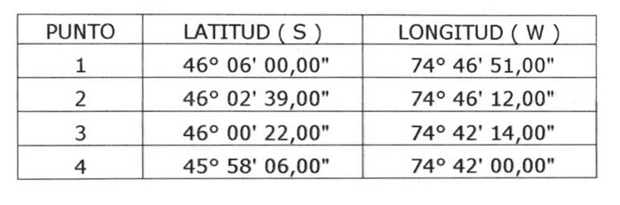
13.- Reemplázase íntegramente el "ÁREA SUR DE
PENÍNSULA DUENDE" por la siguiente:
"ÁREA: SUR DE PENÍNSULA DUENDE
Carta SHOA vigente N° 8800, escala 1:300.000,
1ª ed. 1949 c/c 1997, Datum Local.
a) Sector: Sur de Península Duende
COORDENADAS NUEVAS (LOCAL)
Punto Latitud S Longitud W
1 46º 05' 29,00" 74º 51' 08,00"
2 46º 05' 29,00" 74º 50' 25,00"
3 46º 07' 37,00" 74º 53' 30,00"
4 46º 07' 00,00" 75º 03' 41,00"
5 46º 05' 29,00" 75º 04' 34,00"
6 46º 05' 29,00" 75º 02' 47,00"
b) Sector: Seno Auxilio
COORDENADAS NUEVAS (LOCAL)
Punto Latitud S Longitud W
1 46º 09' 33,00" 74º 52' 00,00"
2 46º 05' 29,00" 74º 47' 25,00"
3 46º 05' 29,00" 74º 46' 36,00"
"
B. Agréganse los siguientes numerales 2 y 3, nuevos:
"2.- Establécense como puntos de fondeo en la XI
Región Aysén del General Carlos Ibáñez del
Campo los siguientes, de acuerdo con Carta
SHOA Nº 8611, escala 1:8.000, edición 2003,
dátum WGS-84:
Punto de Fondeo Nº 1
Eslora Máxima : 150 m
Calado : Sin restricción
Tipo de Fondeo : Fango
Profundidad : 30 m
Punto Latitud S Longitud W
A 45º 28' 33,00" 72º 50' 03,00"
Punto de Fondeo Nº 2
Eslora Máxima : 190 m
Calado : Sin restricción
Tipo de Fondeo : Fango
Profundidad : 70 m
Punto Latitud S Longitud W
A 45º 28' 18,00" 72º 49' 54,00"
Punto de Fondeo Nº 3
Eslora Máxima : 100 m
Calado : Sin restricción
Tipo de Fondeo : Fango
Profundidad : 41 m
Punto Latitud S Longitud W
A 45º 28' 30,00" 72º 49' 42,00"
Punto de Fondeo Nº 4
Eslora Máxima : 190 m
Calado : Sin restricción
Tipo de Fondeo : Fango
Profundidad : 66 m
Punto Latitud S Longitud W
A 45º 28' 17,00" 72º 49' 33,00"
Punto de Fondeo Nº 5
Eslora Máxima : 100 m
Calado : Sin restricción
Tipo de Fondeo : Fango
Profundidad : 30 m
Punto Latitud S Longitud W
A 45º 28' 23,00" 72º 50' 15,00"
3.- En las A.A.A. fijadas en este Decreto Supremo se
podrán realizar actividades de acuicultura
respecto de todo grupo de especies
hidrobiológicas, sin más restricciones que
aquellas fijadas en legislación aplicable."
III. Sin perjuicio de las modificaciones a los D.S. (M) Nº 359, de 1995, y Nº 350, de 1996, efectuadas por el presente decreto, en aquellas áreas que hayan sido desafectadas de su condición de A.A.A. en virtud del D.S. (M) Nº 252, de 3 de septiembre de 2009, del Ministerio de Defensa Nacional, se entenderán subsistentes tales A.A.A. para todos los efectos, sólo en la extensión de aquellas concesiones de acuicultura que se encontraran vigentes a la fecha de publicación del D.S. (M) Nº 252 en el Diario Oficial, hasta que tales concesiones de acuicultura terminen por cualquier causa legal.
Lo anterior se entiende sin perjuicio de lo dispuesto en el número II.- del D.S. (M) Nº 252 antes citado.
NOTA
La letra C del Numeral I del Decreto 2348 exento, Defensa, publicado el 26.08.2011, introdujo diversas modificaciones en la presente norma. Por cuanto respecto de algunas de ellas no fue posible la elaboración un nuevo texto a partir del vigente, no se ha podido incorporar dichas modificaciones en esta actualización.
La letra C del Numeral I del Decreto 2348 exento, Defensa, publicado el 26.08.2011, introdujo diversas modificaciones en la presente norma. Por cuanto respecto de algunas de ellas no fue posible la elaboración un nuevo texto a partir del vigente, no se ha podido incorporar dichas modificaciones en esta actualización.
IV. Anótese, comuníquese y publíquese en el Diario Oficial.- Por orden del Sr. Presidente de la República, Jaime Ravinet de la Fuente, Ministro de Defensa Nacional.
Lo que transcribe para su conocimiento.- Alfonso Vargas Lyng, Subsecretario para las Fuerzas Armadas.